FLUS-UGB多情景模拟的珠江三角洲城市增长边界划定
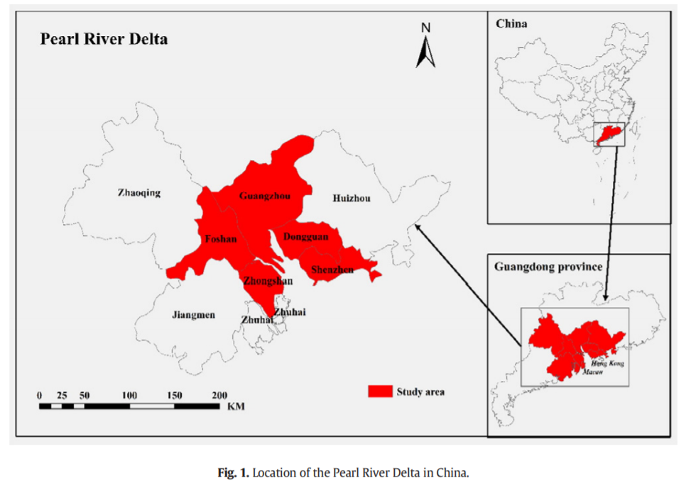
AbstractArising from rapid growth of economy and population,urban sprawl has become a major challenge for sustainable urban development in the world.


AbstractArising from rapid growth of economy and population,urban sprawl has become a major challenge for sustainable urban development in the world.
AbstractLand use and land cover change (LUCC) simulation models are effective and reproducible tools for analyzing both the causes and consequences of
AbstractIn high spatial resolution (HSR) imagery scene classification, it is a challenging task to recognize the high-level semantics from a large vol
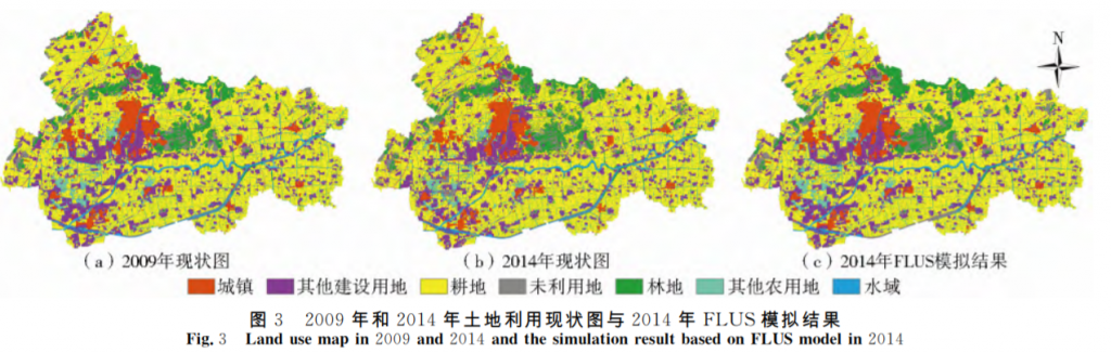
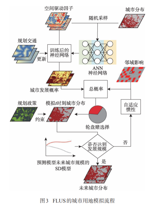
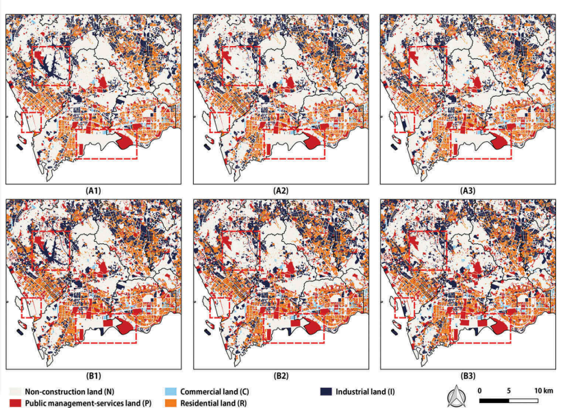
Abstract城镇用地增长边界划定对城镇用地扩张调控与管理具有重要意义,但当前仍无统一划定思路与方法。基于“反规划”理念,引入FLUS模型探讨城镇用地增长边界划定思路,并以徐州市贾汪区为例,采用2009年和2014年数据对FLUS模型可靠性进行验证,对2020年研究区土地利用变化进行情景模拟,在此
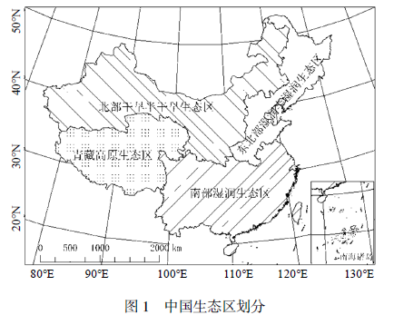
摘要通过将中国划分为4个生态区,在综合考虑社会经济和自然因素的前提下,利用系统动力学的原理和方法,选取对土地利用变化影响最大的驱动因素,分区构建中国土地利用变化系统动力学模型并模拟4种发展情景下2050年中国土地利用变化情况。结果表明:在不同情景设定下,土地利用变化差异较大,其中平稳发展情景较理想,
AbstractCellular automata (CA) have been widely used to simulate complex urban development processes. Previous studies indicated that vector-based cel
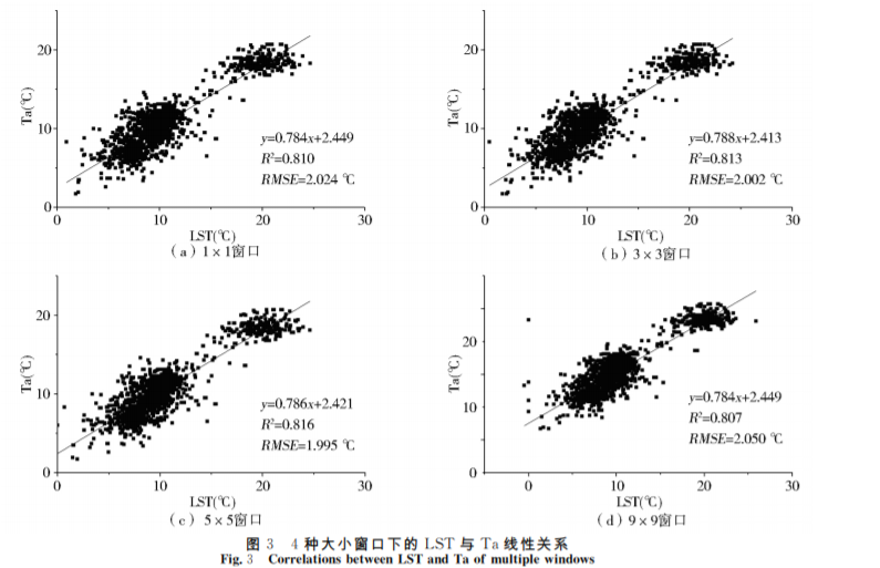
摘要气温(T)是描述陆地气候环境的一个重要参数,其异常变化直接影响人类的生存环境,因此如何高精度地估算气温成为当前研究的热点。MODIS数据因其分辨率较低不能提供精细的地表信息,为此,本文以更高分辨率的Landsat-8影像为数据源,结合自动气象站的气温数据,耦合经纬度、归一化植被指数、归一化建筑指
AbstractUrban land use information plays an important role in urban management, government policy-making, and population activity monitoring. However,
AbstractGlobal land-use and land-cover change (LUCC) data are crucial for modeling a wide range of environmental conditions. So far, access to high-re
AbstractUrbanization has profoundly altered the terrestrial ecosystem carbon cycle, especially the net primary productivity (NPP). Many attempts have
UrbanComp
![]()
![]()
![]()