面向国土空间规划实施评估的双路径土地利用变化模拟方法

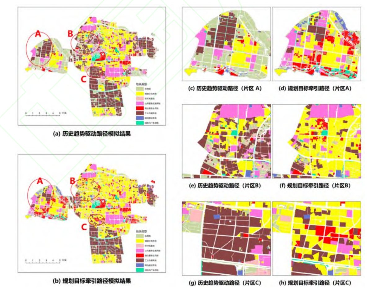
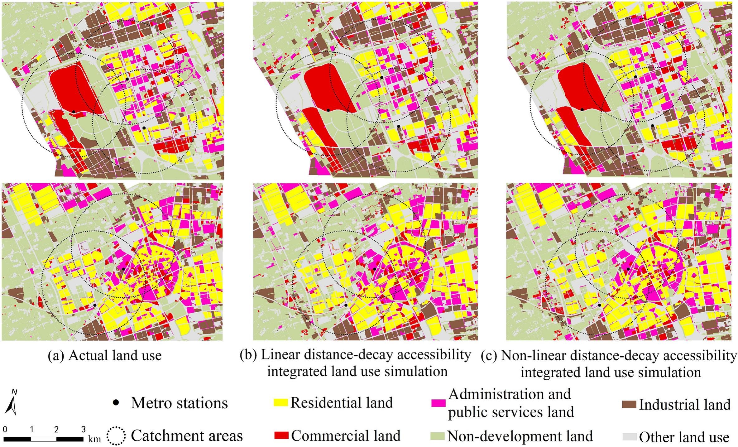
规划实施评估和重点区域调控是国土空间规划进入实施管理阶段后的重要需求。现有土地利用变化模拟多侧重单一路径下的格局预测,难以在统一条件下辨析历史惯性与规划目标导向的差异。为此,提出一种融合历史变化基线与规划目标导向的双路径土地利用变化模拟方法。基于 2019—2024 年土地利用、空间驱动与约束及 2035 年国土空间规划数据,采用马尔可夫链模型与矢量元胞自动机模型构建历史趋势驱动路径;以现状与规划目标的差额为数量约束,构建规划目标牵引路径;进而对双路径结果进行数量结构、空间配置和规划偏离对比与叠置诊断。以常州市武进区中心城区为研究区,结果表明:模型回测中,数量预测的 L1 精度为 0.98,空间模拟的总体精度、Kappa 系数和优值因子分别为 0.92、0.90 和 0.26;双路径差异主要集中于农用地、城镇住宅用地、工业仓储用地和商业服务业用地,并在外围发展区、既有开发区及工业连续带边缘集聚;双路径协调区、历史惯性偏离区、规划实施难点区和规划调整不稳定区分别占研究区的 48.21%、18.90%、27.12%和 5.77%。


Breaking the black box: an interpretable machine learning model for global terrorism forecasting

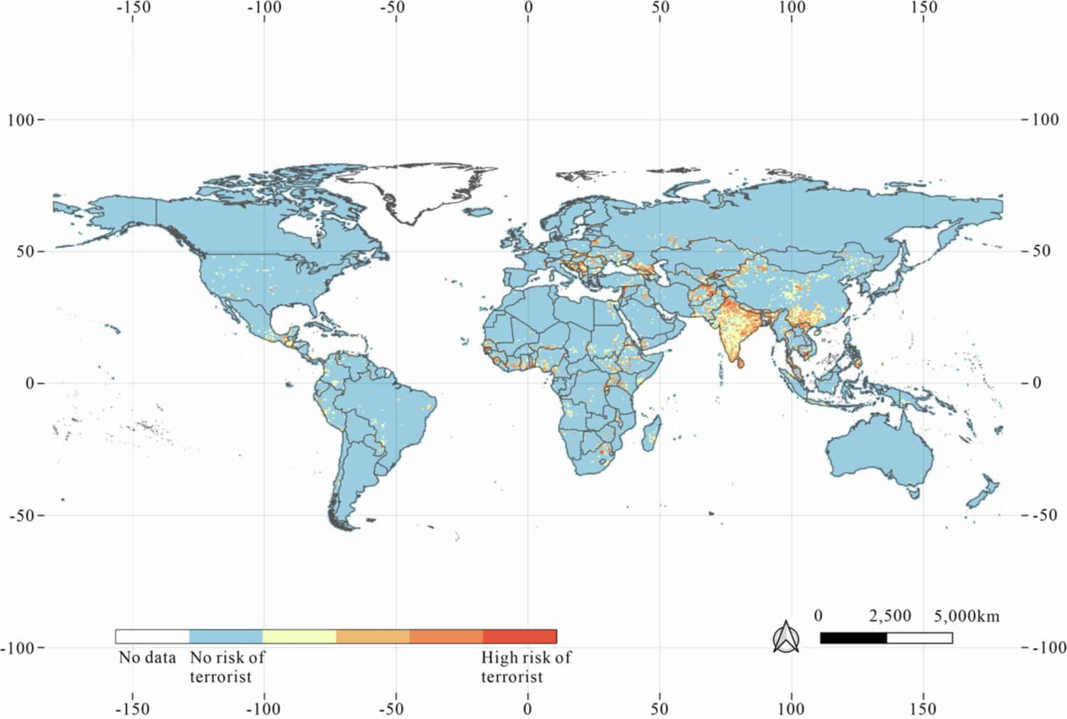
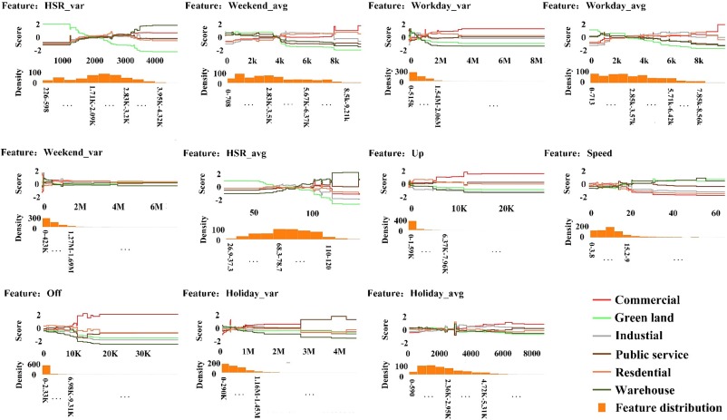
Terrorist attacks significantly threaten a nation’s stability, prosperity, and social cohesion. Therefore, predicting terrorist attacks and identifying their underlying drivers are crucial for formulating effective counterterrorism strategies. Existing studies often prioritize either temporal or spatial dimensions, while their interplay and specific socioeconomic drivers are less explored. In this study, global news data are leveraged to construct a novel global conflict index (GCI), which integrates multisource datasets to comprehensively characterize the key drivers of terrorist attacks. TerrorXG is proposed to predict terrorist attacks, and SHAP analysis is applied to quantitatively interpret the importance and contributions of the driving factors. TerrorXG demonstrated superior performance (RMSE: 0.319; PCC: 0.777) and high computational efficiency. Compared with the second most influential factor (population size), the proposed GCI has a 42.4% greater impact on terrorist attacks. The interpretability analysis of the model highlights socioeconomic inequality as a primary determinant: the impacts of child malnutrition and infant mortality are 38.4% to 108.5% greater than the effect of urbanization. The influence of ethnicity represents only 9.7% of the impact of the GCI, providing empirical evidence that challenges traditional theoretical perspectives on ethnic conflict in terrorism research. This study provides valuable insights for optimizing the allocation of counterterrorism resources.


MGIM: Masked Geo-Inference for Land Parcels

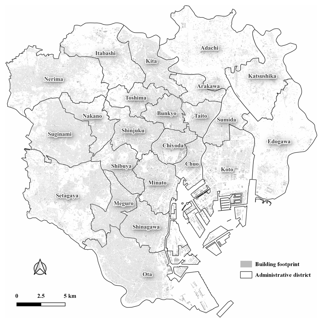
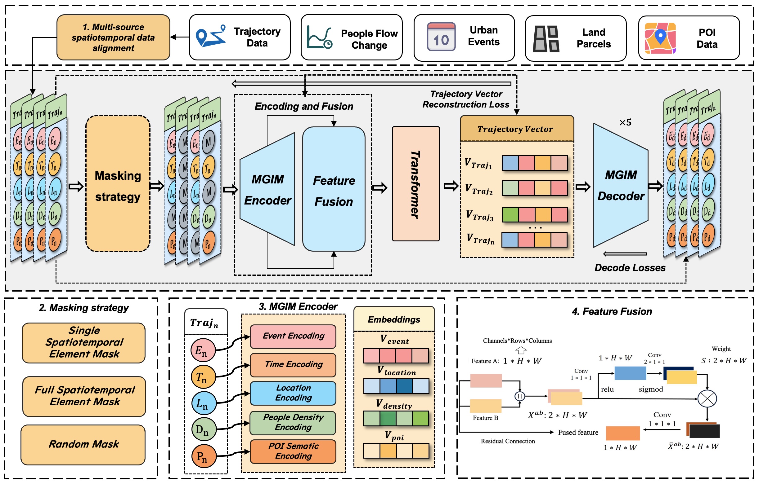
Effective modeling of spatio-temporal contexts to support geographic reasoning is essential for advancing Geospatial Artificial Intelligence. Inspired by masked language models, this paper introduces the Masked Geographical Information Model (MGIM), a novel self-supervised framework for learning context-aware representations from multi-source spatio-temporal data. The framework’s core innovations include a parcel-scale method for multi-source data fusion and a custom self-supervised masking strategy for diverse geographic elements. This integrated modeling approach enables the model to capture complex spatio-temporal relationships and achieve consistently strong performance across diverse geographic reasoning tasks, such as trajectory inference, people flow inference, event identification, and land parcel function analysis. MGIM accurately reasons from spatio-temporal contexts and dynamically adjusts inferences according to contextual changes. The visualization of attention mechanisms further illustrates MGIM’s capacity to construct contextually-aware representations and task-specific attention patterns analogous to natural language processing models. This study presents a new paradigm for general-purpose spatio-temporal modeling in real-world geographic scenarios, offering significant theoretical and practical value, and promising an effective solution for building a geographic foundation model.