多源空间大数据场景下的家装品牌线下广告选址布局研究
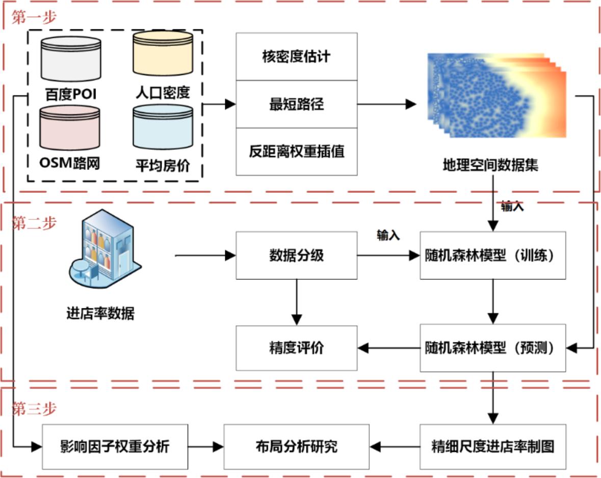
摘要合理进行线下广告牌投放位置的选择,对商家宣传品牌以及扩大营销市场具有十分积极的作用。由于商业数据较难获取,以往研究多停留在宏观理论层面,未能对线下广告选址的实际布局进行细尺度分析。本研究以北京为研究区,通过耦合某大型家装品牌户外广告到店转化率和路网、感兴趣点数据(point of interes


摘要合理进行线下广告牌投放位置的选择,对商家宣传品牌以及扩大营销市场具有十分积极的作用。由于商业数据较难获取,以往研究多停留在宏观理论层面,未能对线下广告选址的实际布局进行细尺度分析。本研究以北京为研究区,通过耦合某大型家装品牌户外广告到店转化率和路网、感兴趣点数据(point of interes
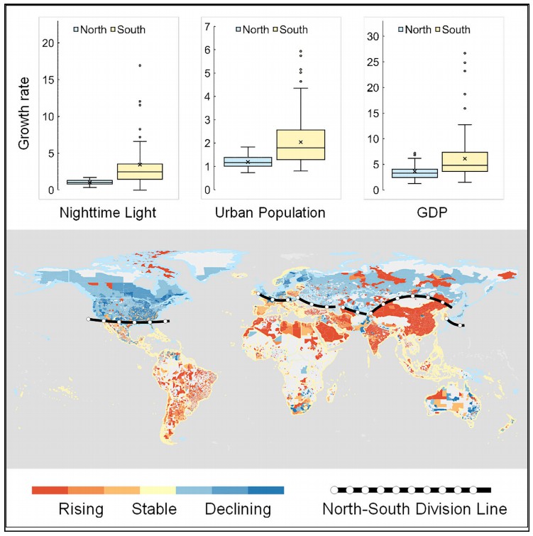
SUMMARYRapid urbanization has tremendously changed the global landscape with profound impacts on our society. Nighttime light (NTL) data can provide v
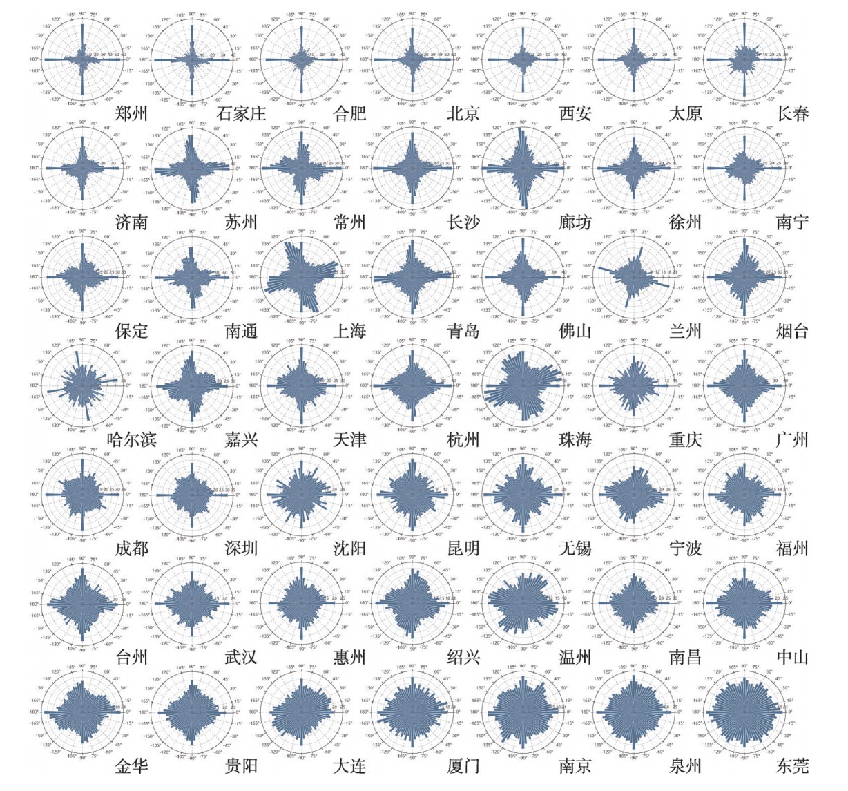
摘要城市化的快速发展推动了我国城市道路网的不断扩张和发展。城市道路网是一个动态、开放、自组织的空间复杂网络,构成了城市的结构框架,研究城市道路网的结构特征对路网规划和城市建设有着重要的应用价值。在国内城市道路网络结构特征的相关研究中,很少有学者基于道路走向的视角对整个城市路网结构进行研究,也缺少对全
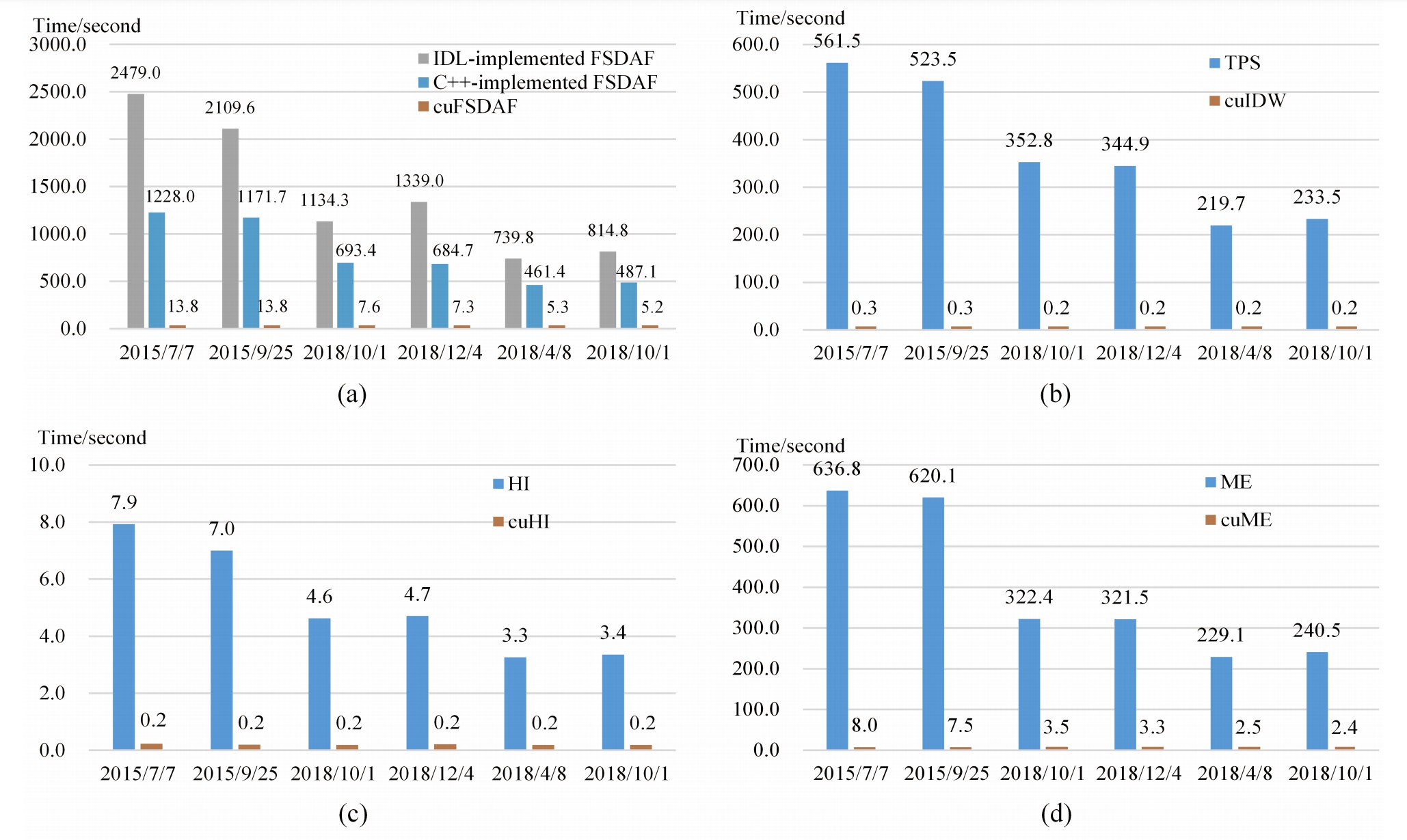
AbstractSpatiotemporal data fusion is a cost-effective way to produce remote sensing images with high spatial and temporal resolutions using multisour
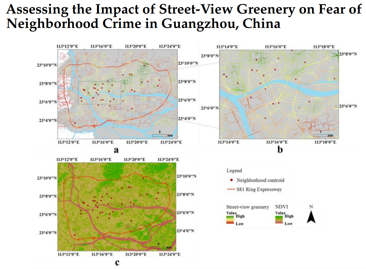
AbstractHuman perception of place refers to residents’ psychological feelings about urban areas. Many studies of human perceptions have focused on a s

AbstractEmpirical data are limited to decipher where people live and work in large cities; however, neighborhood information, such as street view imag
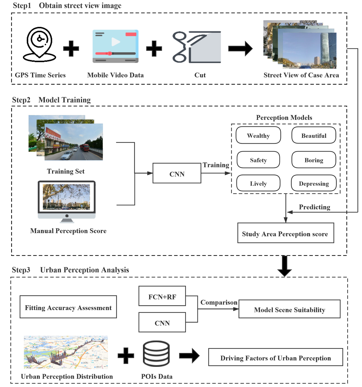
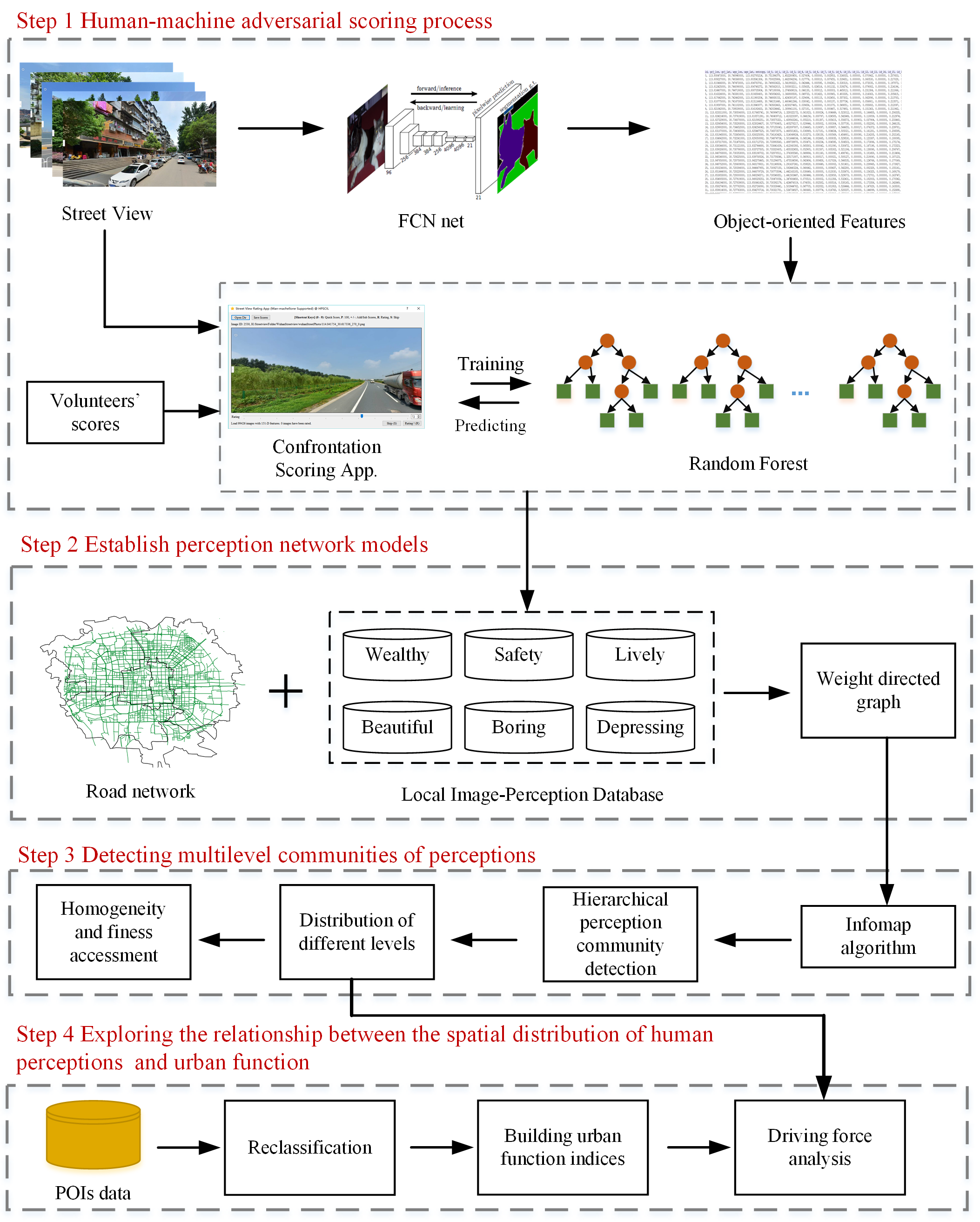
AbstractUrban perception is a hot topic in current urban study and plays a positive role in urban planning and design. At present, there are two metho
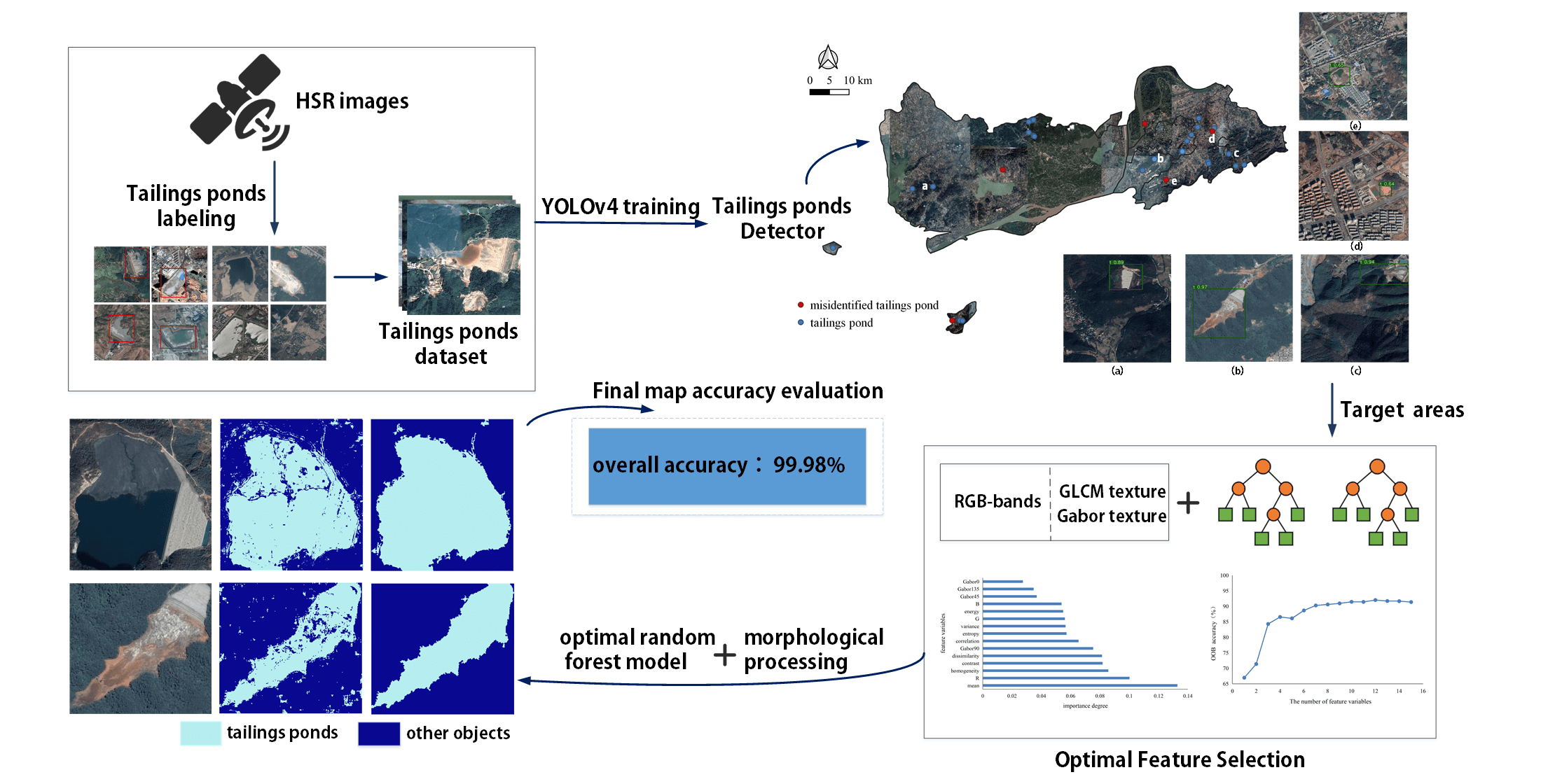
AbstractDue to a lack of data and practical models, few studies have extracted tailings pond margins in large areas. In addition, there is no public d
摘要针对高分辨率遥感影像中地物的复杂性和多变性带来的地物提取难点,提出了一种基于多层次规则的面向对象的典型地物提取方法。改进了基于区域增长的影像分割方法,利用小区域内的全局最优策略进行初始增长,避开了种子点的选择。利用影像分割得到的影像对象作为地物提取的基元,针对影像上典型地物选择提取特征 ,利用多
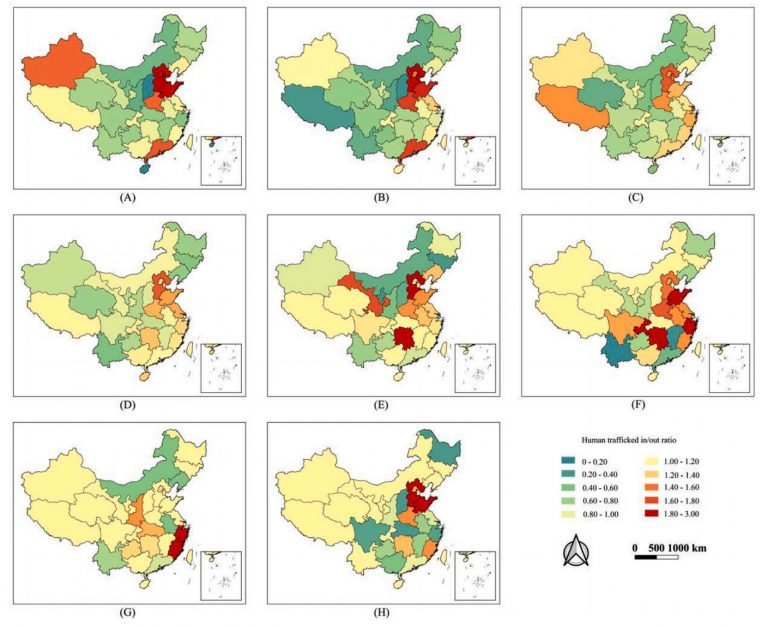
AbstractIn China, the illegal adoption of missing persons and especially of missing children is a major public safety issue that affects social and fa
UrbanComp
![]()
![]()
![]()