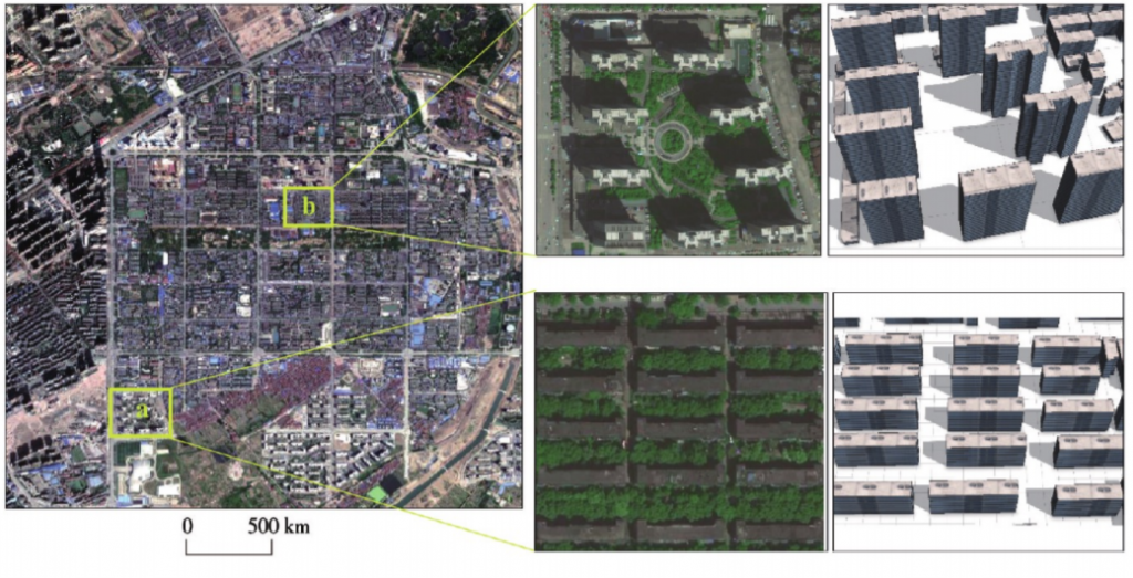
Augmented Reality (AR) for geographic data is an important development direction of geographic information visualization. In recent years, some geographic studies have begun to use head-wear AR devices to visualize geographic data, making geographic spatial information more fully expressed. However, due to the limited computing power of head-wear AR devices, most of existing geographic information AR studies focus on the visualization of geographic information, yet do not provide complex spatial analysis and computation functions. This paper presents a framework for spatial analysis on AR devices by edge-cloud integration. In order to achieve efficient and end- to-end collaborative computation, the AR device is responsible for spatial data visualization, human-computer interaction, and data preprocessing; while the cloud server is responsible for complex spatial analysis tasks and persistent storage of spatial data. The binary storage method of edge-cloud and the coordinate conversion module between the 3D visualization model and the 3D geographic model provide efficient links between AR end and cloud end. Specifically, the framework divides three-dimensional geospatial data into three-dimensional AR visualization model data and three-dimensional geographic model data with attribute information, which are stored in AR and the server, respectively. The coordinates of the threedimensional AR visualization model and geospatial coordinates are mapped using Bursa-wolf seven-parameter coordinate transformation method. Finally, HTTP protocol is used to transmit data to achieve high efficiency and end-to-end collaborative computing. Based on this framework, this paper used Hololens, a head-mounted AR device, and based on three-dimensional building data in Wuhan and a sky vis如lity factor algorithm, to realize complex spatial computation in the meantime of AR visualization. The findings suggest that our framework can provide smooth and stable 3D visualization (FPS was about 35) while guaranteeing the efficiency and accuracy of the complex sky-view factor computation. In conclusion, the edge-cloud integration technology can enable AR devices to perform complex spatial analysis and computation

Q.E.D.


