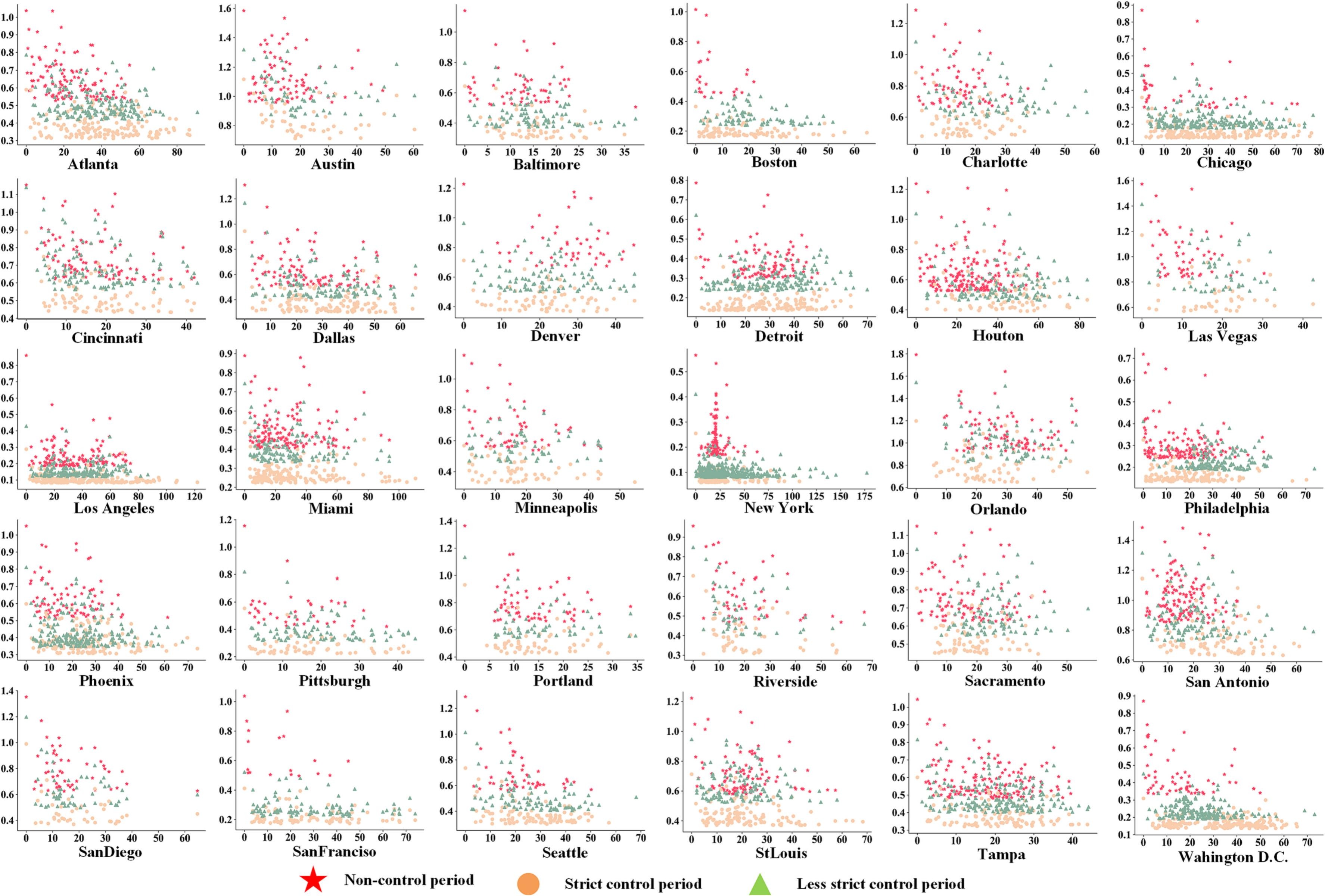
Gauging urban resilience in the U.S. during the COVID-19 pandemic via social network analysis
Title: Gauging urban resilience in the United States during the COVID-19 pandemic via social network analysis


Title: Gauging urban resilience in the United States during the COVID-19 pandemic via social network analysis
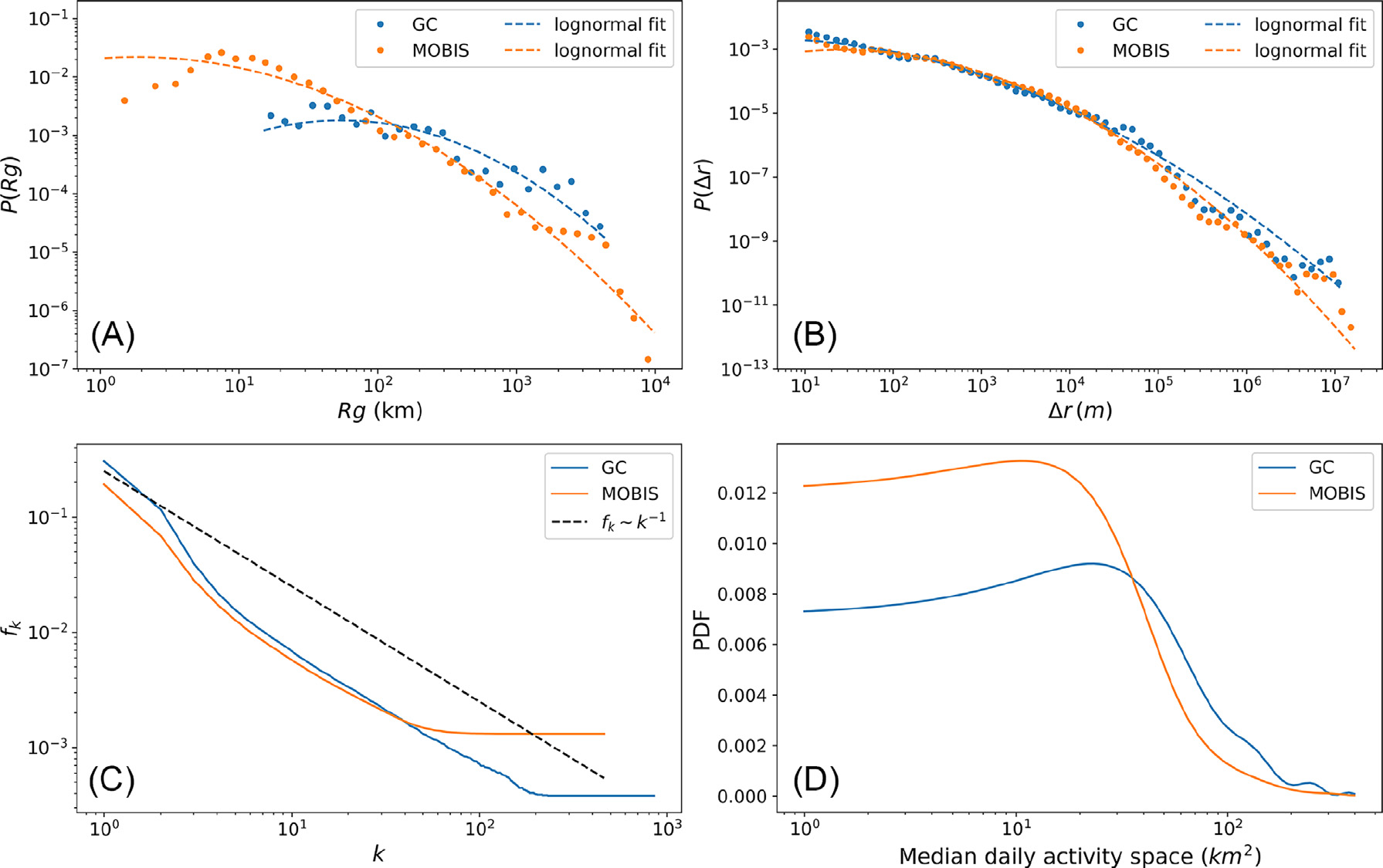
Title: Conserved quantities in human mobility: From locations to tripsAbstractQuantifying intra-person variability in travel choices is essential for
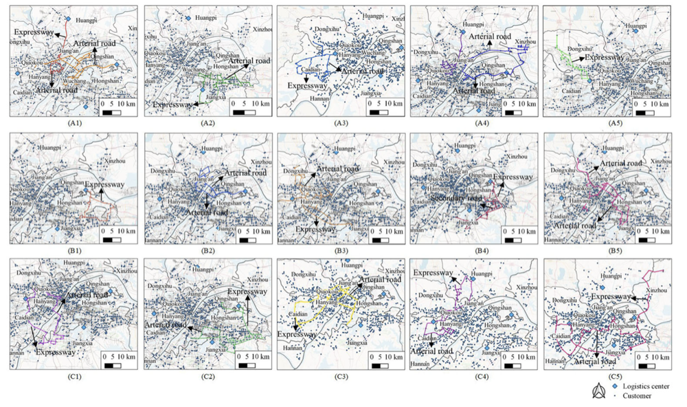
Title:Fast optimization for large scale logistics in complex urban systems using the hybrid sparrow search algorithmAbstractUrban logistics is vital t
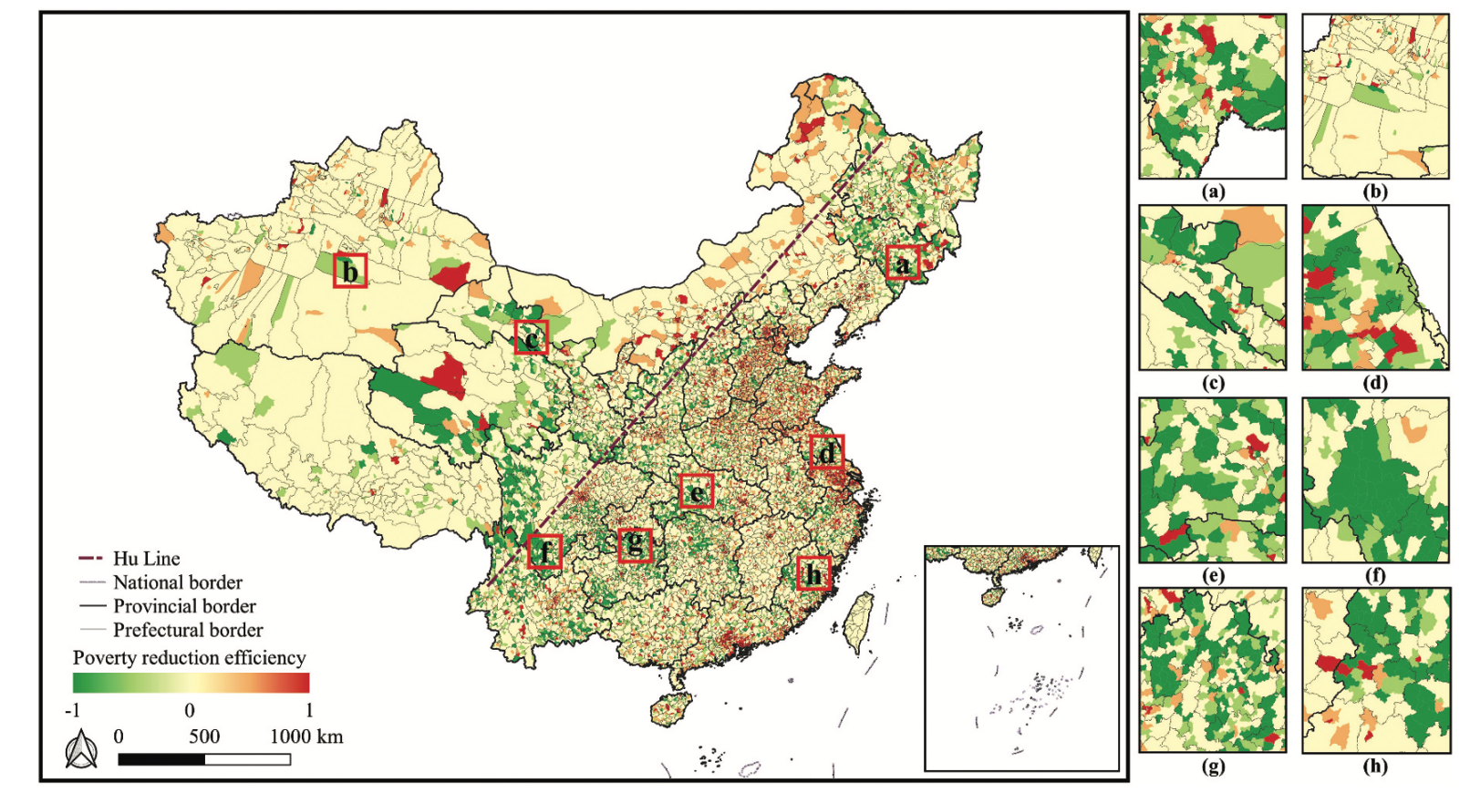
Title:Estimating China’s poverty reduction efficiency by integrating multi-source geospatial data and deep learning techniquesAbstractPoverty threaten
Title:Extracting human perceptions from street view images for better assessing urban renewal potentialHighlightsHuman visual and emotional perception

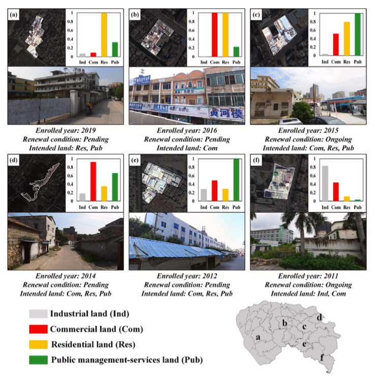
交通驱动下微观地块尺度的城市土地利用变化模拟 —— 以深圳市为例摘要城市交通作为土地利用空间格局变化的重要驱动因素,在城市发展模拟研究中值得重视。如何有效挖掘城市交通因素并引入地块尺度城市土地利用模拟成为重要议题。本文提出一套基于矢量元胞自动机考虑交通因素的城市土地利用变化模拟框架(T-VCA)。该
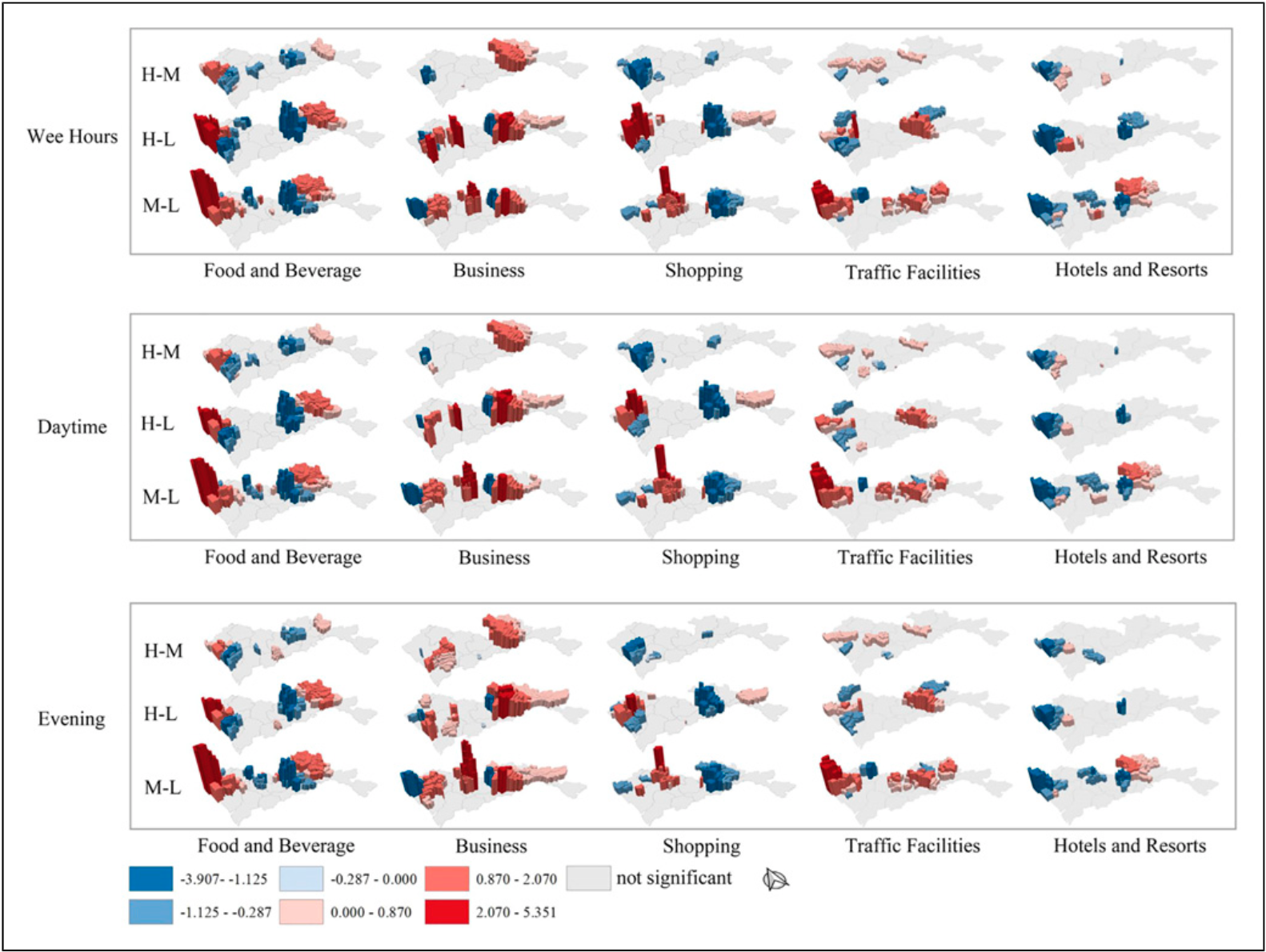
Title:How do urban services facilities affect social segregation among people of different economic levels? A case study of Shenzhen cityAbstractSocia

Title:The inequalities of different dimensions of visible street urban green space provision: A machine learning approachHighlightsA machine-learning
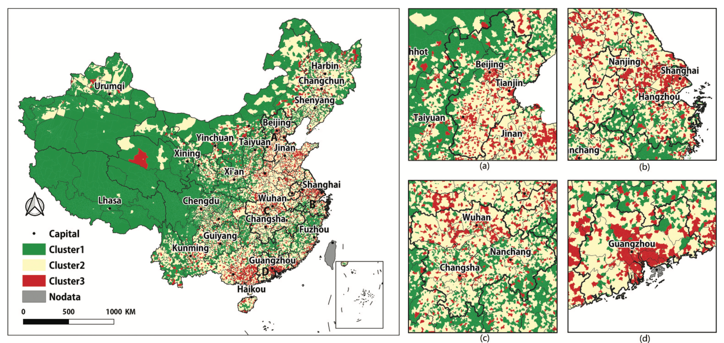
Title:Understanding China’s urban functional patterns at the county scale by using time-series social media dataAbstractUnderstanding urban functions
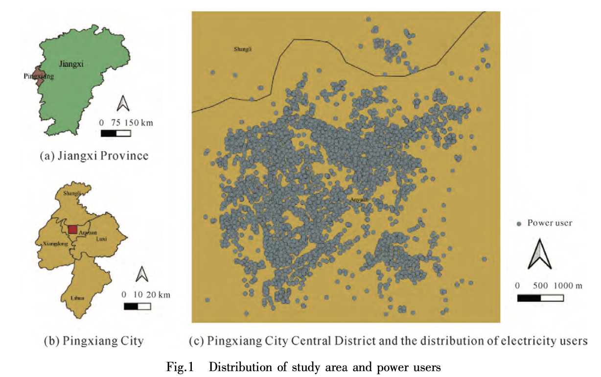
Title:Estimating the spatial variation of electricity consumputionAbstractEffective detection of abnormal electricity users and analysis of the spatia
UrbanComp
![]()
![]()
![]()