


Abstract
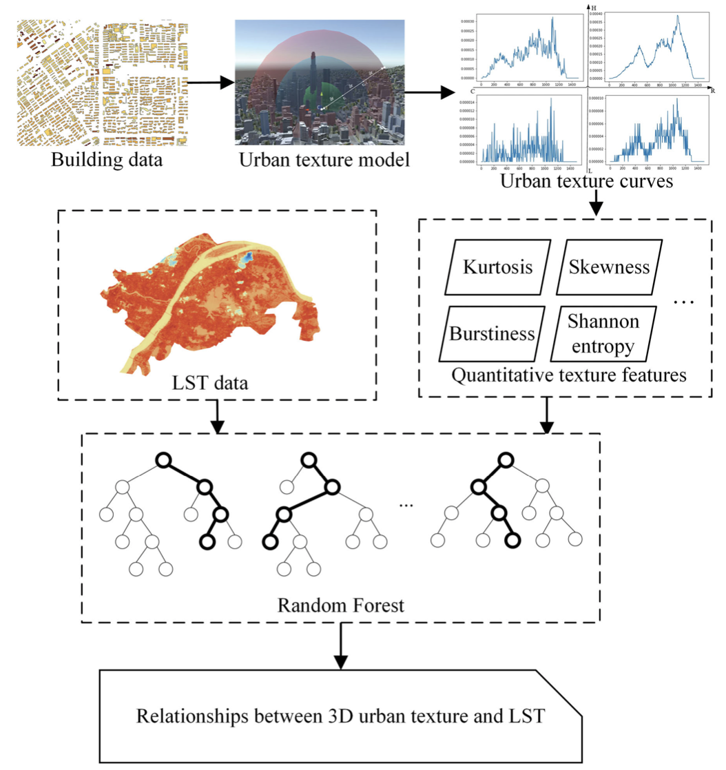
The spatial distribution of buildings is one of the key factors influencing the local environment within a city. The quantitative measurement of building distribution can provide critical information for exploring local climate patterns in urban areas. Previous studies mainly focused on the two-dimensional spatial distribution of buildings and ignored the differences in height. In this study, a three-dimensional (3D) urban texture model based on an improved radial distribution function is proposed to describe the 3D spatial distribution of urban buildings. Using a set of concentric domes above the ground, a texture curve can be generated at any location in a city, from which a variety of numerical features are extracted to depict the local 3D urban landscape quantitatively. The proposed model was applied to Wuhan, one of the largest cities in central China, and the results demonstrated that the proposed model could identify various building distribution patterns in the city. Additionally, the relationship between urban texture and land surface temperature in Wuhan was analyzed. It was found that the 3D urban texture model effectively improved the accuracy of land surface temperature estimation. This study provides a new tool for urban environmental assessment and urban planning decision making.
Key Words: 3D urban texture model, radial distribution function, urban structure, urban surface temperature.
软件下载
UrbanTexture v1.0:基于改进RDF的三维城市纹理计算软件(PC端)
Q.E.D.