


Title
Classifying land-use patterns by integrating time-series electricity data and high-spatial resolution remote sensing imagery
Highlights
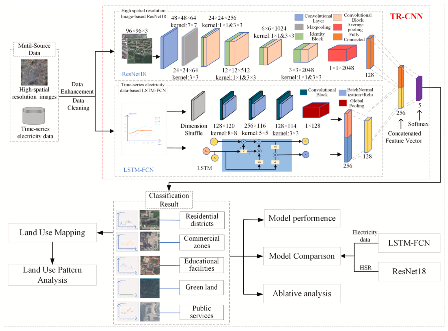
- A deep learning model (TR-CNN) for land-use classification at fine scale is proposed.
- TR-CNN can fuse multi-source features from HSR and electricity data.
- Electricity data is first proved to reflect socioeconomic features of land use.
- TR-CNN obtained 0.934 accuracy, which can accurately identify land-use types.
- TR-CNN can sense land-use patterns from both “top-down” and “bottom-up” recognition
Abstract
Accurate identification of urban land-use patterns is essential to rational optimization of urban structure. By combining the external physical characteristics of city parcels obtained from remote sensing images and the socioeconomic attributes revealed by social sensing data, land use can be better classified. However, most of the existing social sensing data have location bias and lack temporal resolution, which cannot accurately reflect the socioeconomic information of land use and leads to low classification accuracy. Based on the above problems, this study explores the deep semantic information of high-spatial and temporal resolution time-series electricity data to explore its relationship with socioeconomic attributes and construct a neural network (TR-CNN) that can fuse time-series electricity data and remote sensing images to identify urban land-use types. We selected Anyuan District in Pingxiang City, Jiangxi Province for a demonstration study, and the results show that the accuracy of the proposed model is 0.934, which is 4.3% and 6.7% higher than that of the ResNet18 model using only remotely sensed images and the LSTM-FCN model using only time-series electricity data. The results also show that the use of time-series electricity data can effectively identify residential and commercial areas, but it is difficult to identify public service facilities compared with remote sensing images. This study finds for the first time that the semantic features of electricity data can fully reflect socioeconomic attributes and can accurately perceive urban land-use patterns from both “top-down” and “bottom-up” recognition patterns by coupling remote sensing images and electricity data.
Keywords
Urban land-use classification; Time-series electricity data; High-spatial resolution images; Feature fusion; Deep learning; TR-CNN
Full-Text Download
Q.E.D.