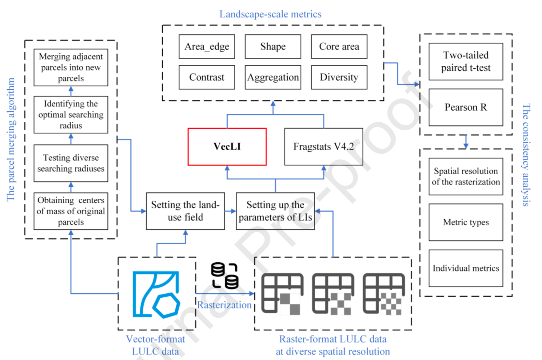
VecLI: A framework for calculating vector landscape indices considering landscape fragmentation
HighlightsA new unifying computational framework for vector-based landscape indices is proposed.74.7% of the VecLI metrics are significantly different


HighlightsA new unifying computational framework for vector-based landscape indices is proposed.74.7% of the VecLI metrics are significantly different
SUMMARYRapid urbanization has tremendously changed the global landscape with profound impacts on our society. Nighttime light (NTL) data can provide v
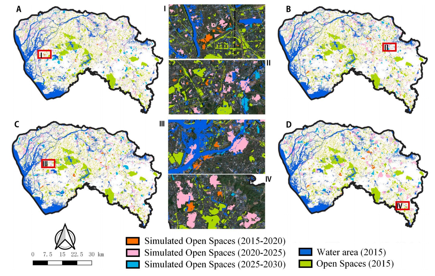
AbstractOpen spaces (OSs) in urban areas play a vital role in providing space for habitat conservation and recreation, improving the mental health of
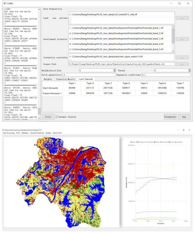
Understanding the drivers of sustainable land expansion using a patch-generating land use simulation (PLUS) model: A case study in Wuhan, China
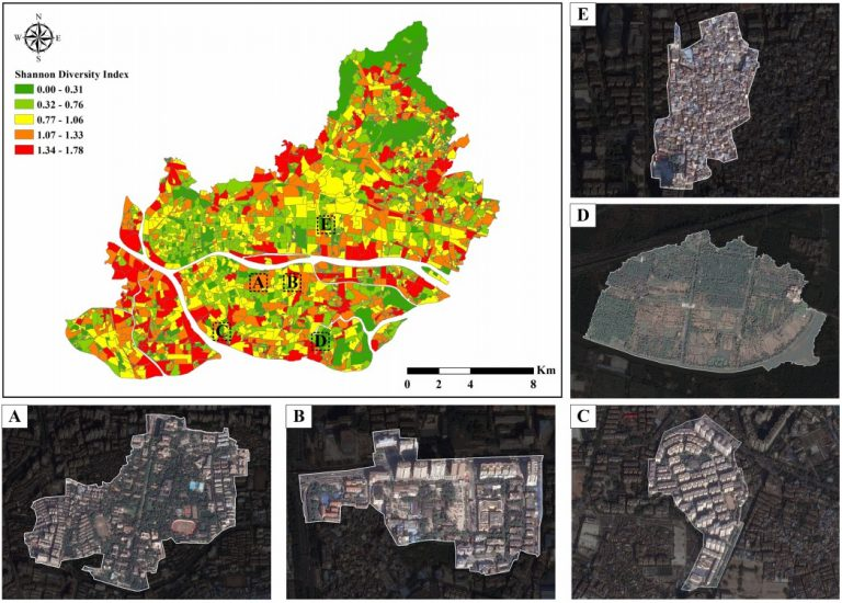
AbstractMixed land use has been widely used as a planning tool to improve the functionality of cities. However, depicting mixed land use is rather dif
AbstractWhen used for land use change modeling, Cellular Automata (CA) usually assume that each cell has only one land use type at each time step, ign
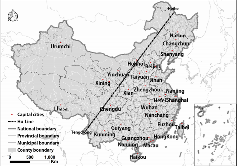
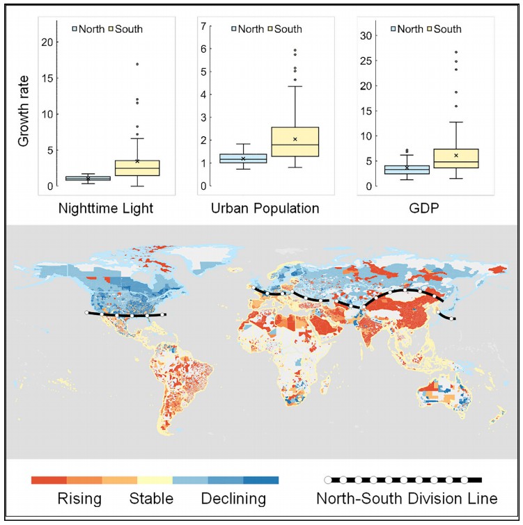
AbstractThe Hu Huanyong Line (Hu Line) shows an uneven geographical pattern of urbanization between Southeast and Northwest China. Based on three ques
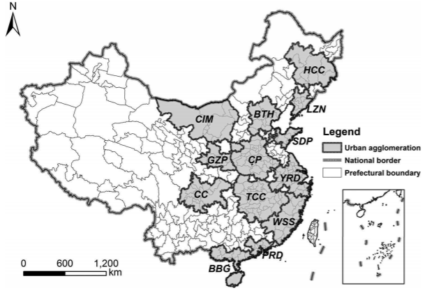
ABSTRATIntercity transportation infrastructures and services determine the depth and breadth of the spatial interactions among cities within an urban
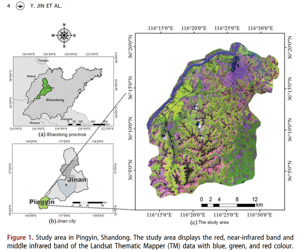
AbstractLand-cover mapping in complex farming area is a difficult task because of the complex pattern of vegetation and rugged mountains with fast-flo
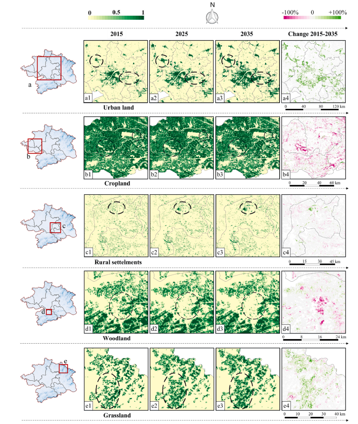
AbstractSimulations of intra-urban land use changes have gradually attracted more attention as these approaches are extremely helpful in regard to dec
UrbanComp
![]()
![]()
![]()