


Abstract
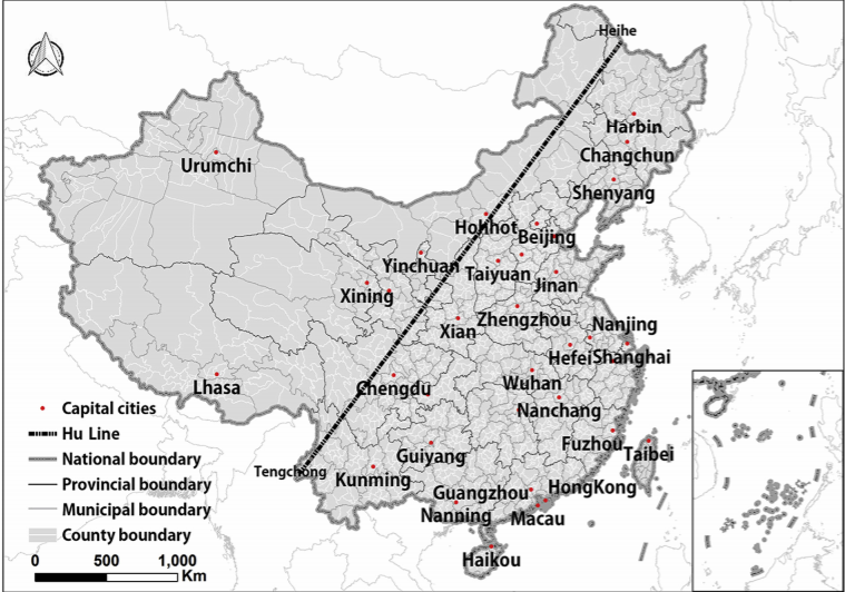
The Hu Huanyong Line (Hu Line) shows an uneven geographical pattern of urbanization between Southeast and Northwest China. Based on three questions proposed by the Chinese Premier, the balance of urbanization on both sides of the Hu Line and the possibility of breaking through the pattern in the future has provoked substantial interest in academic circles. Based on quantitative analyses and urban simulations, this study proposes a large-scene urbanization quantitative spatial analysis framework via nighttime light and random forests-based cellular automata and explores changes in the urbanization of the Hu Line pattern in the context of the Belt and Road Initiative. This study analyzes the past urbanization status on both sides of the Hu Line and predicts the future distribution and proportion of urban land on both sides of the Hu Line in the context of the Belt and Road Initiative. The new impacts that the Belt and Road Initiative may bring to the domestic regions are concretized and coupled with cellular automata. The results show that the proportion of urban land on both sides of the Hu Line was 93.94:6.06 in 2005 and that it will reach 93.07:6.93 in 2035. A significant difference in urbanization is revealed between the two sides; however, the difference decreases annually. Overall, the distribution of urbanization in China will retain the southeast-northwest pattern of the Hu Line in 2015-2035.
Q.E.D.