Assessing the Impact of Street-View Greenery on Fear of Neighborhood Crime in Guangzhou, China
摘要针对高分辨率遥感影像中地物的复杂性和多变性带来的地物提取难点,提出了一种基于多层次规则的面向对象的典型地物提取方法。改进了基于区域增长的影像分割方法,利用小区域内的全局最优策略进行初始增长,避开了种子点的选择。利用影像分割得到的影像对象作为地物提取的基元,针对影像上典型地物选择提取特征 ,利用多


摘要针对高分辨率遥感影像中地物的复杂性和多变性带来的地物提取难点,提出了一种基于多层次规则的面向对象的典型地物提取方法。改进了基于区域增长的影像分割方法,利用小区域内的全局最优策略进行初始增长,避开了种子点的选择。利用影像分割得到的影像对象作为地物提取的基元,针对影像上典型地物选择提取特征 ,利用多
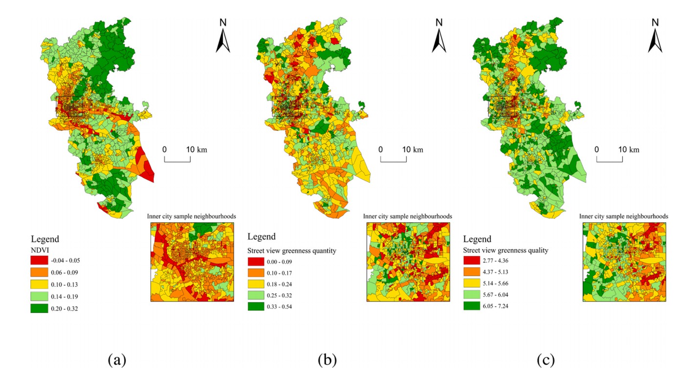
Awareness is mounting that urban greenspace is beneficial for residents’ health. While a plethora of studies have focused on greenspace quantity, scant attention has been paid to greenspace quality. Existing methods for assessing greenspace quality is either highly labor-intensive and/or prohibitively time-consuming. This study develops a new machine learning method to assess greenspace quality based on street view images collected from Guangzhou, China. It also examines whether greenspace exposure disparities are linked to the neighbourhood socioeconomic status (SES). The validation process indicated that our scoring system achieved high accuracy for predicting street view-based greenspace quality outside the training data. Results also show that there were marked differences in spatial distribution between aggregated NDVI (Normalized Difference Vegetation Index), street view greenness quantity and quality. Regression models show that neighbourhood SES is not associated with NDVI. Although neighbourhood SES is associated with both street view greenness quantity and quality index value, street view greenness quality is more sensitive to the change of neighbourhood SES. Our work suggests that policymakers and planners are advised to pay more attention to greenspace quality and greenspace exposure disparities in urban area.
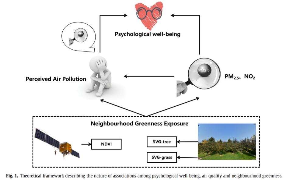
[Residential-greenness-air-pollution-and-psychological-well-being-among-urban-residents-in-Guangzhou-China](http://www.urbancomp.net/wp-
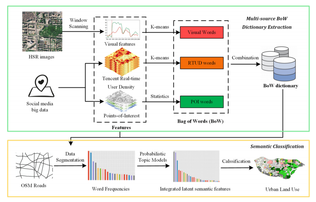
AbstractThe rapid development of information technology and location techniques not only leads to an increasing growth of massive geospatial big data
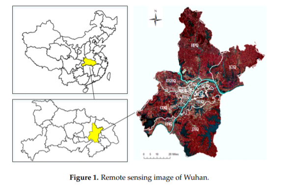
AbstractWith the acceleration of the process of building a national-level central city in Wuhan, the landscape pattern of the city has undergone treme
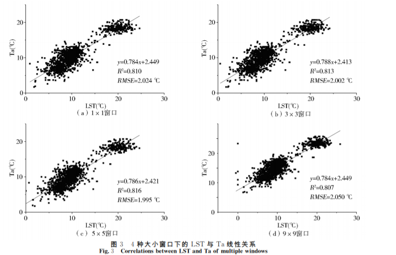
摘要气温(T)是描述陆地气候环境的一个重要参数,其异常变化直接影响人类的生存环境,因此如何高精度地估算气温成为当前研究的热点。MODIS数据因其分辨率较低不能提供精细的地表信息,为此,本文以更高分辨率的Landsat-8影像为数据源,结合自动气象站的气温数据,耦合经纬度、归一化植被指数、归一化建筑指
AbstractSerious air pollution has recently aroused wide public concerns in China. The traditional method of quantitative remote sensing model is not o
UrbanComp
![]()
![]()
![]()