
How perception of neighborhood safety influences urban residents’ mental health
AbstractPrevious studies have shown that perceptions of neighborhood safety are associated with various mental health outcomes. However, scant attenti


AbstractPrevious studies have shown that perceptions of neighborhood safety are associated with various mental health outcomes. However, scant attenti
ABSTRATPrevious studies have shown that perceptions of neighborhood safety are associated with various mental health outcomes. However, scant attentio
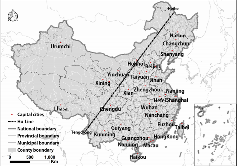
AbstractThe Hu Huanyong Line (Hu Line) shows an uneven geographical pattern of urbanization between Southeast and Northwest China. Based on three ques
_1628244912138.jpg)
AbstractBuilt environment attributes have been demonstrated to be associated with various health outcomes. However, most empirical studies have typica
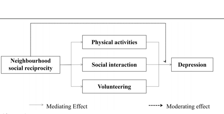
AbstractBackground: This study aims to investigate the mechanisms through which neighborhood social reciprocity influences older adults' mental health

ABSTRATBackground: Neighbourhood environment characteristics have been found to be associated with residents’ willingness to conduct physical activity
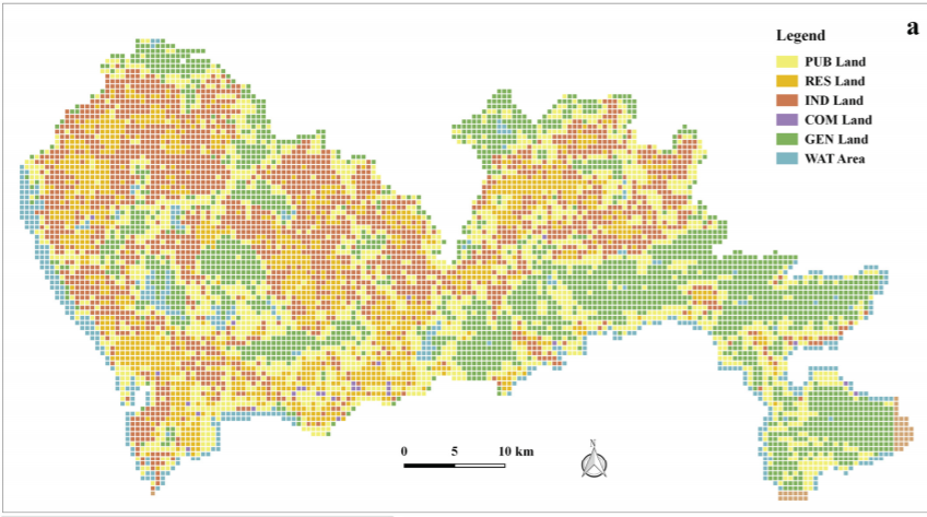
ABSTRATThe significance of urban function recognition has stimulated the need for multi-source geospatial data fusion, especially the fusion between r
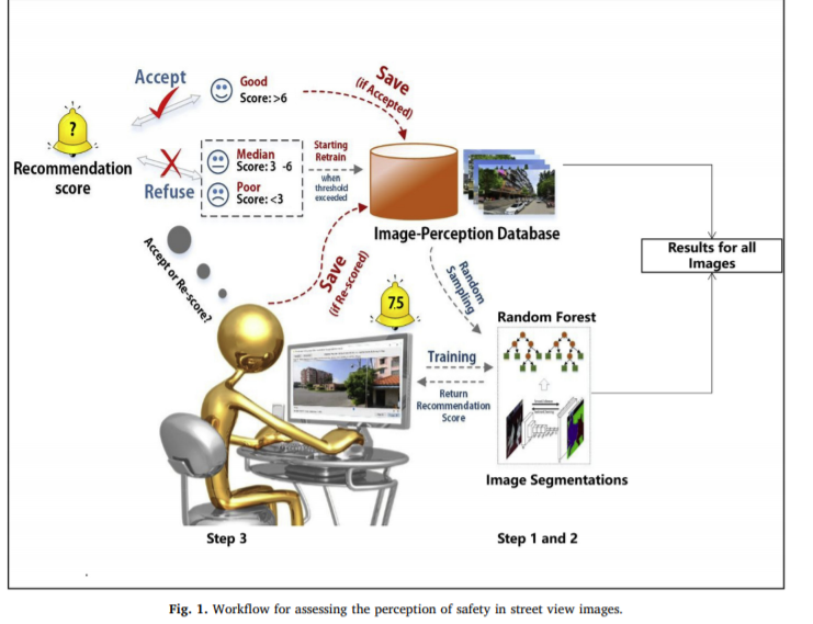
ABSTRATThough global-coverage urban perception datasets have been recently created using machine learning, their efficacy in accurately assessing loca
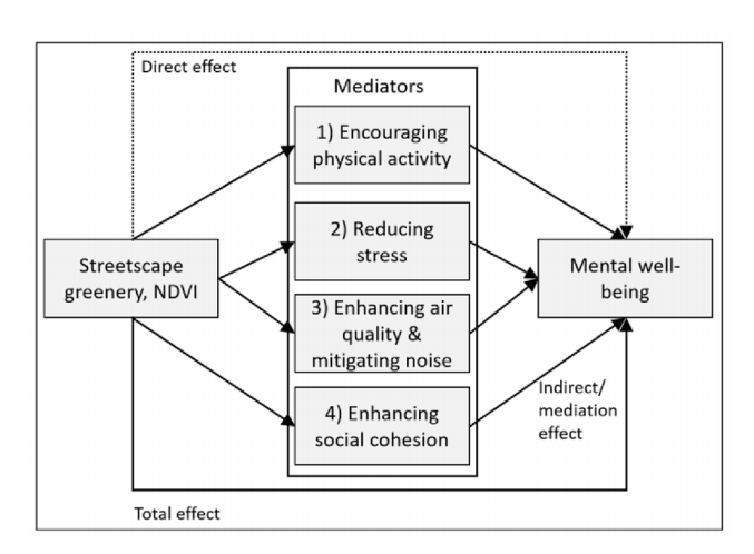
ABSTRATBackground: Multiple mechanisms have been proposed to explain how greenery in the vicinity of people’s homes enhances their mental health and w
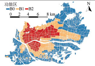
ABSTRAT地理时空大数据被广泛用于城市功能结构识别,其中功能层次性的研究对于系统理解城市功能的结构特征和分布形态具有重大意义,但相关研究仍处于空缺状态。 基于时序出租车出行数据和感兴趣点数据描述居民出行模式,结合动态时间规整和K-MEDOIDS聚类算法识别城市的功能属性和空间结构。 研究结果表明
UrbanComp
![]()
![]()
![]()