


Title: Representation learning for geospatial data
Abstract
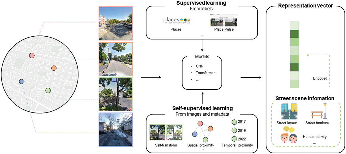
This paper reviews representation learning for geospatial data, focusing on methods for automatically extracting meaningful features from diverse data types. By simplifying tasks and improving accuracy, representation learning has emerged as a powerful tool for geospatial analysis. Due to its generalizability and scalability, representation learning provides an effective approach to processing geospatial data, which is inherently diverse and unstructured. We summarize the representation learning methods for different geospatial data types, including locations, points of interest (POIs), trajectories, spatial interactions, remote sensing imagery, and street view imagery. Treating each data type as a distinct modality, we emphasize the potential of multi-modal representation learning to advance the understanding of geographical phenomena and propose an LLM-guided framework as a potential solution. The review concludes by highlighting the need for further research to improve multi-modal data alignment and enhance the interpretability of feature representations, particularly in complex and dynamic geographical environments.
Keywords
Representation learning;
geospatial data;
multi-modal representation learning
Full Text Download
Q.E.D.