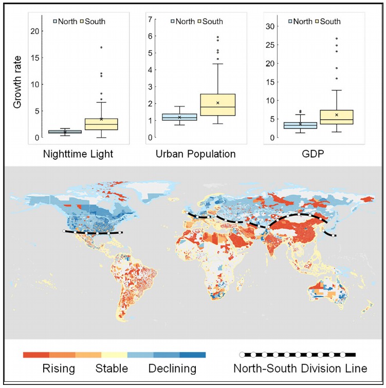
A global North-South division line for portraying urban development
SUMMARYRapid urbanization has tremendously changed the global landscape with profound impacts on our society. Nighttime light (NTL) data can provide v


SUMMARYRapid urbanization has tremendously changed the global landscape with profound impacts on our society. Nighttime light (NTL) data can provide v
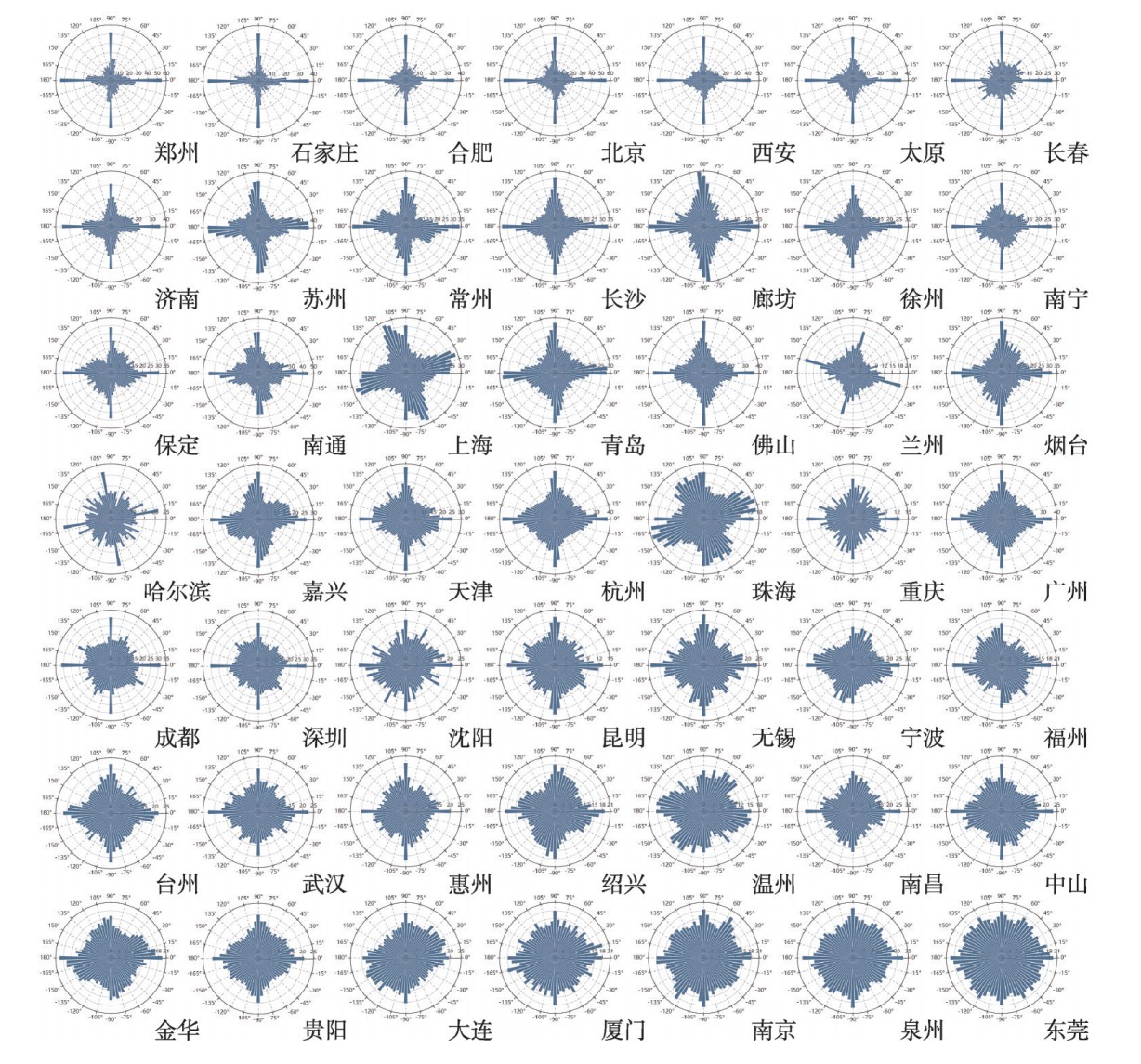
摘要城市化的快速发展推动了我国城市道路网的不断扩张和发展。城市道路网是一个动态、开放、自组织的空间复杂网络,构成了城市的结构框架,研究城市道路网的结构特征对路网规划和城市建设有着重要的应用价值。在国内城市道路网络结构特征的相关研究中,很少有学者基于道路走向的视角对整个城市路网结构进行研究,也缺少对全
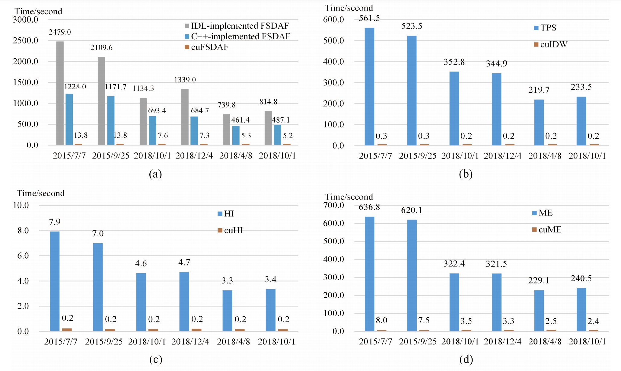
AbstractSpatiotemporal data fusion is a cost-effective way to produce remote sensing images with high spatial and temporal resolutions using multisour
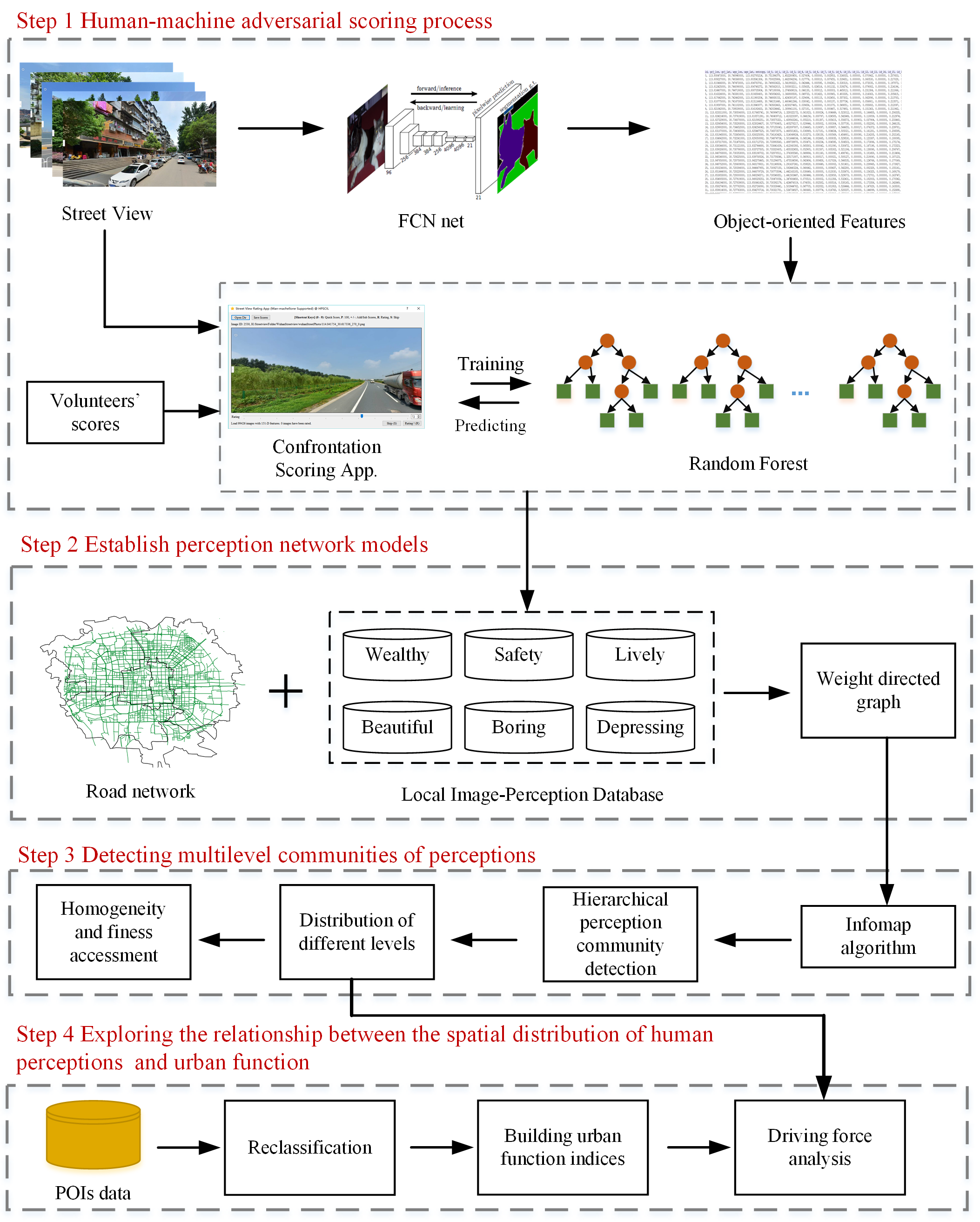
AbstractHuman perception of place refers to residents’ psychological feelings about urban areas. Many studies of human perceptions have focused on a s
AbstractSensing urban greenness from street view data offers a new and alternative way of measuring the association between greenness exposure and su
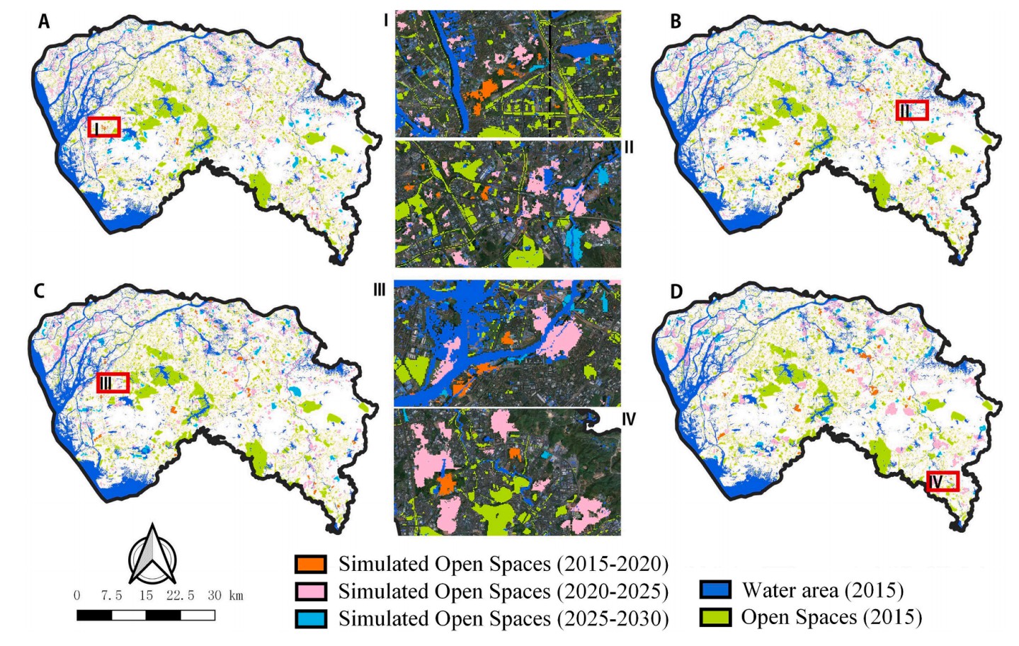
AbstractOpen spaces (OSs) in urban areas play a vital role in providing space for habitat conservation and recreation, improving the mental health of

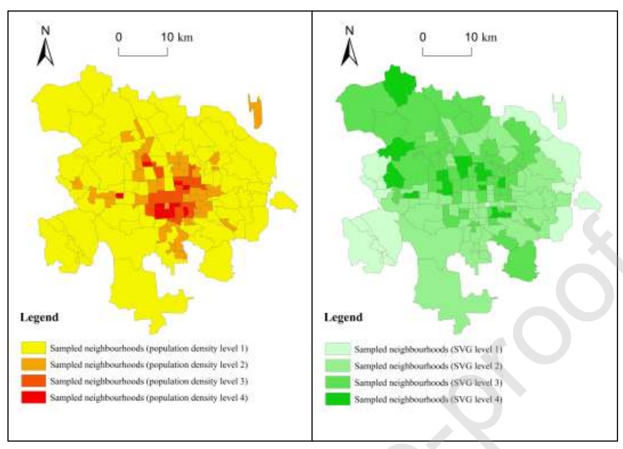
AbstractEmpirical data are limited to decipher where people live and work in large cities; however, neighborhood information, such as street view imag
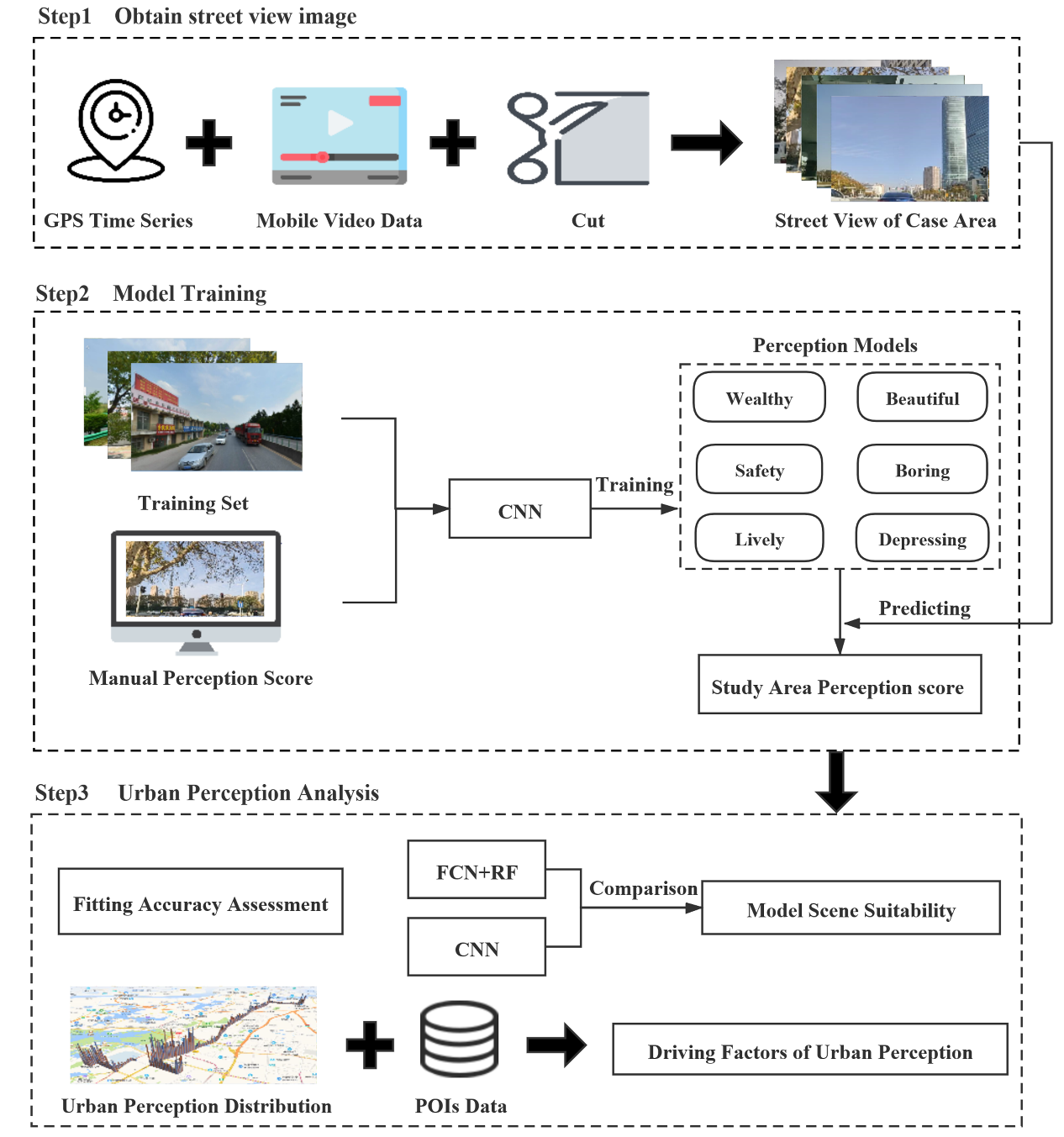
AbstractUrban perception is a hot topic in current urban study and plays a positive role in urban planning and design. At present, there are two metho
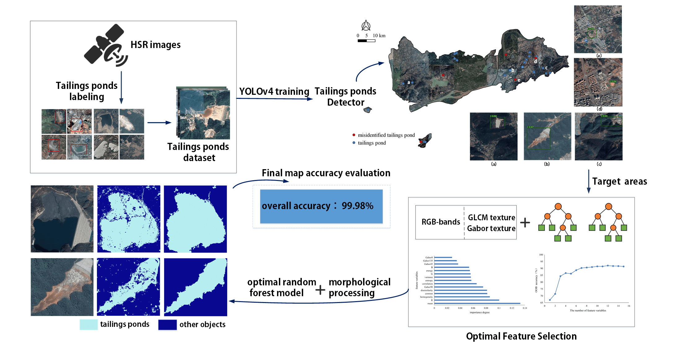
AbstractDue to a lack of data and practical models, few studies have extracted tailings pond margins in large areas. In addition, there is no public d

AbstractPrevious literature has examined the relationship between the amount of green space and perceived safety in urban areas, but little is known a
UrbanComp
![]()
![]()
![]()