


Abstract
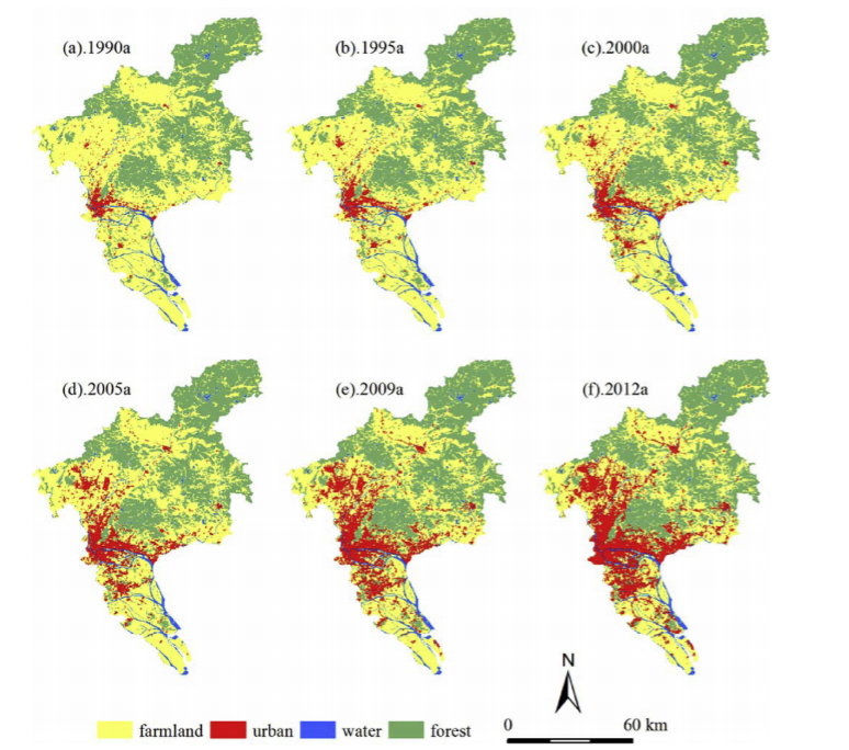
Cellular automata (CA) have proven to be very effective for simulating and predicting the spatio-temporal evolution of complex geographical phenomena. Traditional methods generally pose problems in determining the structure and parameters of CA for a large, complex region or a long-term simulation. This study presents a self-adaptive CA model integrated with an artificial immune system to discover dynamic transition rules automatically. The model's parameters are allowed to be self-modified with the application of multi-temporal remote sensing images: that is, the CA can adapt itself to the changed and complex environment. Therefore, urban dynamic evolution rules over time can be efficiently retrieved by using this integrated model. The proposed AIS-based CA model was then used to simulate the rural-urban land conversion of Guangzhou city, located in the core of China's Pearl River Delta. The initial urban land was directly classified from TM satellite image in the year 1990. Urban land in the years 1995, 2000, 2005, 2009 and 2012 was correspondingly used as the observed data to calibrate the model's parameters. With the quantitative index figure of merit (FoM) and pattern similarity, the comparison was further performed between the AIS-based model and a Logistic CA model. The results indicate that the AIS-based CA model can perform better and with higher precision in simulating urban evolution, and the simulated spatial pattern is closer to the actual development situation
Q.E.D.