


Abstract
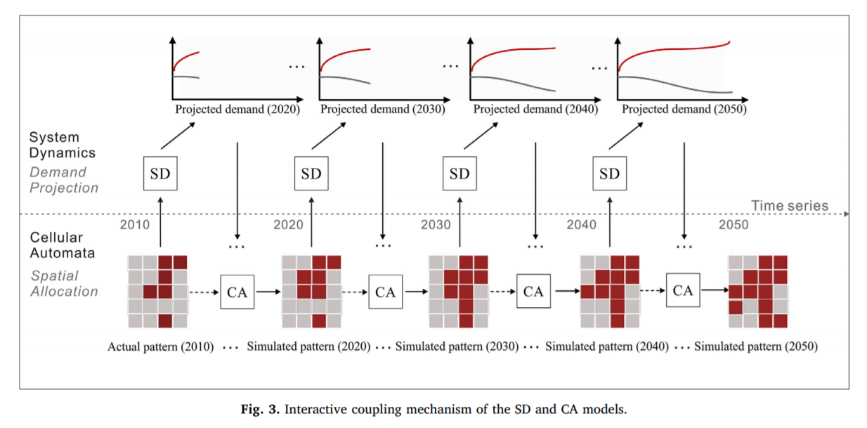
Urban growth boundaries (UGBs) have been commonly regarded as a useful tool for controlling urban sprawl. There is a need to create models that can establish plausible UGBs for fast growing regions. Previous methods have merely focused on establishing a single UGB scenario over different time intervals, but rarely considered the influences of macro policy (e.g., future urban demand) and spatial policy (e.g., master plan) for regional planning. However, the spatial patterns of urban expansion are significantly affected by regional planning. In this paper, a CA-based method called the future land use simulation (FLUS) is applied to the delineation of UGBs. We argue that the delineation needs to integrate the top-down approach with CA for projecting complex land use changes under designed scenarios. The system dynamics model (SD) and cellular automaton model (CA) were interactively coupled in the FLUS model during the projection period. The top-down SD is used to project scenarios that relate to macro policy and socioeconomic status, and the bottom-up CA accounts for urban growth simulations under the influence of different driving factors and spatial planning policies. A morphological technology based on erosion and dilation is further proposed to generate the UGBs from the FLUS model's simulated urban forms. The proposed UGB-FLUS model was applied to the establishment of UGBs in the Pearl River Delta region (PRD) from 2020 to 2050. The results demonstrate that the method can support urban planning by generating feasible patterns for UGBs under different planning scenarios.
Q.E.D.