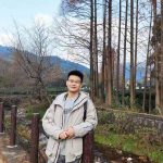
张亚涛学者个人简历

Name: Yatao Zhang
Email: yatau@foxmail.com
Phone: 86-15626197252
https://www.researchgate.net/profile/Yatao_Zhang3
EDUCATION:
Wuhan University Wuhan, China MSc, Cartography and Geographical Information System, Score: 90/100 2017.09 – 2020.06
State Key Laboratory of Information Engineering in Surveying, Mapping and Remote Sensing
Sun Yat-sen University Guangzhou, China
BS, Geographical Information Science, Score: 91/100 2013.08 – 2017.06
School of Geography and Planning
RESEARCH SKILLS :
Urban Computing and Sensor Application
Multi-Source Spatiotemporal Big Data Mining and Fusion
Machine Learning, Computer Vision and Natural Language Processing
IELTS: 7.0; Programming: C++, Python; Software: ArcGIS, QGIS, ENVI, eCognition, etc.
PUBLICATIONS:
Journal Articles (* Corresponding Author)
Tu, W., Zhang, Y.*, Li, Q., & Mai, K. (2020). Scale effect on fusing remote sensing and human sensing to portray urban functions. IEEE Geoscience and Remote Sensing Letters, DOI: 10.1109/LGRS.2020.2965247.
Tu, W., Mai, K., Zhang, Y., Xu, Y., Huang, J., Deng, M., Chen, L. & Li, Q. (2020). Real-time route recommendations for E-taxies leveraging GPS trajectories. IEEE Transactions on Industrial Informatics, DOI: 10.1109/TII.2020.2990 206.
Zhang, Y., Li, Q., Tu, W.*, Mai, K., Yao, Y., & Chen, Y. (2019). Functional urban land use recognition integrating multi-source geospatial data and cross-correlations. Computers, Environment and Urban Systems, 78, 101374.
Yao, Y., Zhang, Y.*, Guan, Q., Mai, K., & Zhang, J. (2019). Sensing multi-level urban functional structures by using time series taxi trajectory data. Geomatics and Information Science of Wuhan University, 44(6), 875-884.
Chen, D., Zhang, Y., Yao, Y.*, Hong, Y., Guan, Q., & Tu, W. (2019). Exploring the spatial differentiation of urbanization on two sides of the Hu Huanyong Line – based on nighttime light data and cellular automata. Applied Geography, 112, 102081.
Mai, K., Tu, W.*, Li, Q., Zhao, T., Zhang, Y., & Ye, H. (2019). STIETR: Spatial-temporal Intelligent E-Taxi Recommendation System Using GPS Trajectories. The 3rd ACM SIGSPATIAL International Workshop on GeoAI.
Tu, W., Li, Q., Zhang, Y., & Yue, Y. (2019). User-generated content and its application in urban studies. In Urban Informatics. Springer. (Accepted as a book chapter of Urban Informatics).
Yao, Y., Hong, Y., Wu, D., Zhang, Y., & Guan, Q. (2018). Estimating the effects of “community opening” policy on alleviating traffic congestion in large Chinese cities by integrating ant colony optimization and complex network analyses. Computers, Environment and Urban Systems, 70, 163-174.
Yao, Y., Liu, X., Li, X., Liu, P., Hong, Y., Zhang, Y., & Mai, K. (2017). Simulating urban land-use changes at a large scale by integrating dynamic land parcel subdivision and vector-based cellular automata. International Journal of Geographical Information Science, 31(12), 2452-2479.
Yao, Y., Liu, X.*, Li, X., Zhang, J., Liang, Z., Mai, K., & Zhang, Y. (2017). Mapping fine-scale population distributions at the building level by integrating multisource geospatial big data. International Journal of Geographical Information Science, 31(6), 1220-1244.
Awards & SCHOLARSHIPS:
2020 Outstanding Postgraduate with Master Degree, Wuhan University
2019 National Scholarship, Wuhan University
2017 Outstanding Undergraduate with Bachelor Degree, Sun Yat-sen University
2016 Paper Award Winner of Chinese Academic Annual Conference of Geographic Information Science
2014 – 2016 Excellent College Student Scholarship of Sun Yat-sen University (Three times)


