


Language: 中文版, English Version(current)
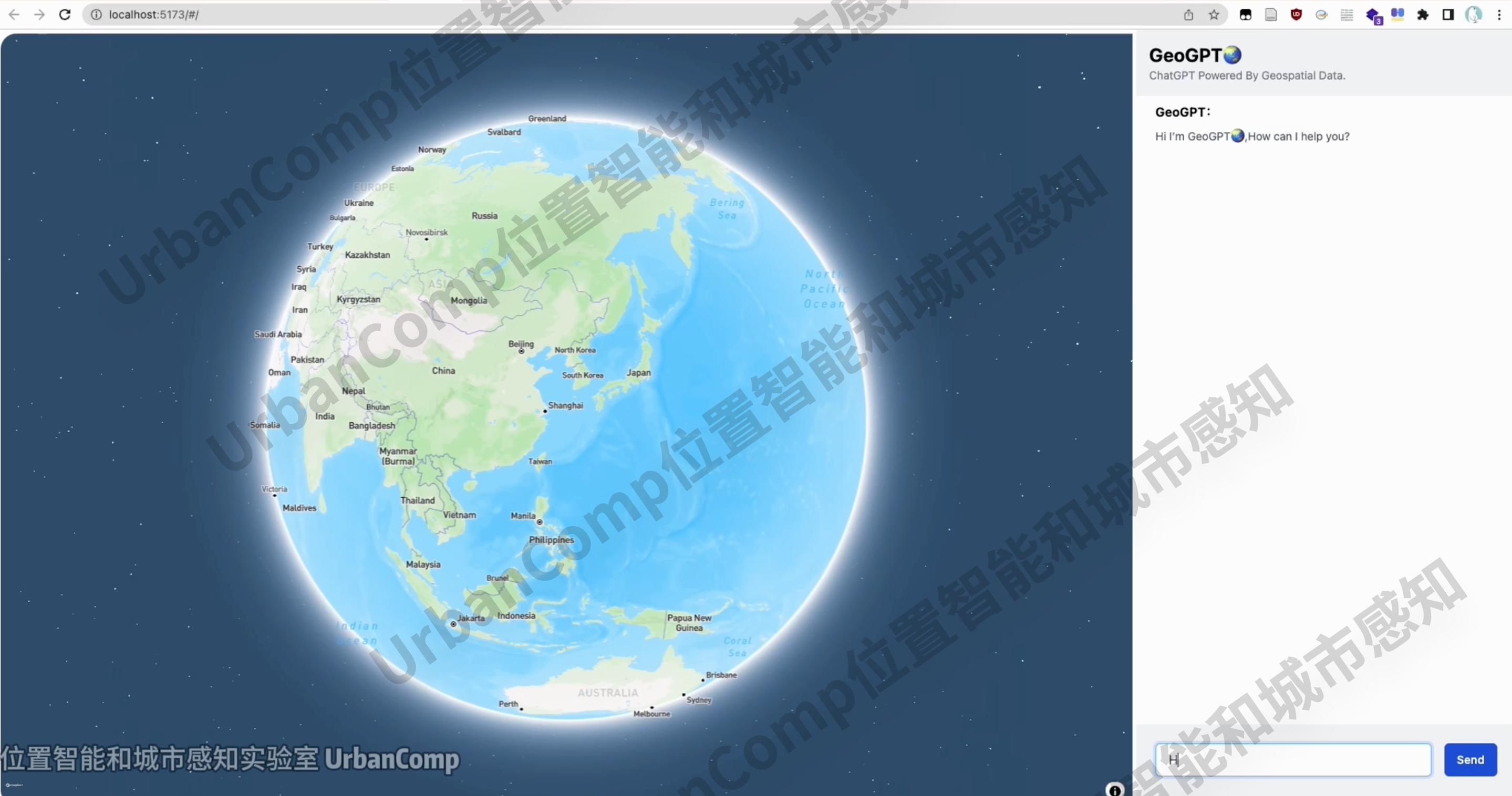
User Interface
Research Background
In the past year, large language models (LLMs) represented by GPT have attracted widespread attention and have nurtured vertical applications in fields such as education and finance that can accurately meet industry-specific needs, with broad application prospects.
With the continuous improvement of LLM itself, coupled with the emergence of third-party frameworks such as LangChain and AutoGen, further technical support has been provided for the practical application of LLM. However, due to the complexity, non-linearity, data diversity of geographical problems, and the lack of complete spatial cognition and spatial data reserves in large language models, it is difficult to integrate existing API services and geographic information data from the geospatial information industry to solve geospatial information problems.
Developing the interaction capability between LLMs and geographic information, expanding and based on this conducting in-depth applications in areas such as geospatial big data analysis, spatial analysis, business site selection, smart maps etc., is a cutting-edge and challenging topic. It is important for breaking down knowledge barriers between ordinary users and professionals while further enhancing efficiency in human-computer interaction.
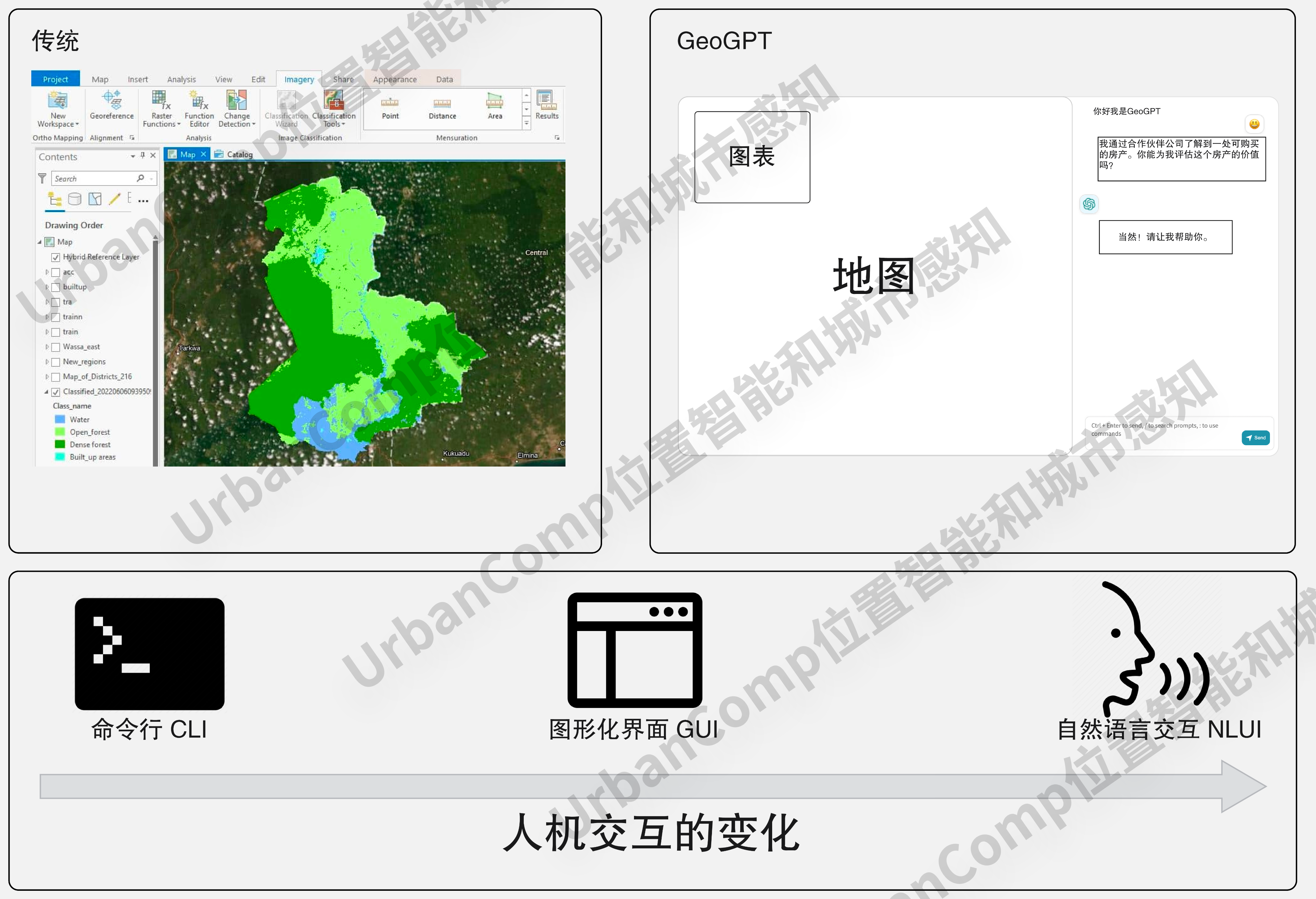
Introduction
GeoGPT is an artificial intelligence assistant developed by the UrbanComp Location Intelligence and Urban Perception team, which integrates large language models (LLM) with geospatial data.
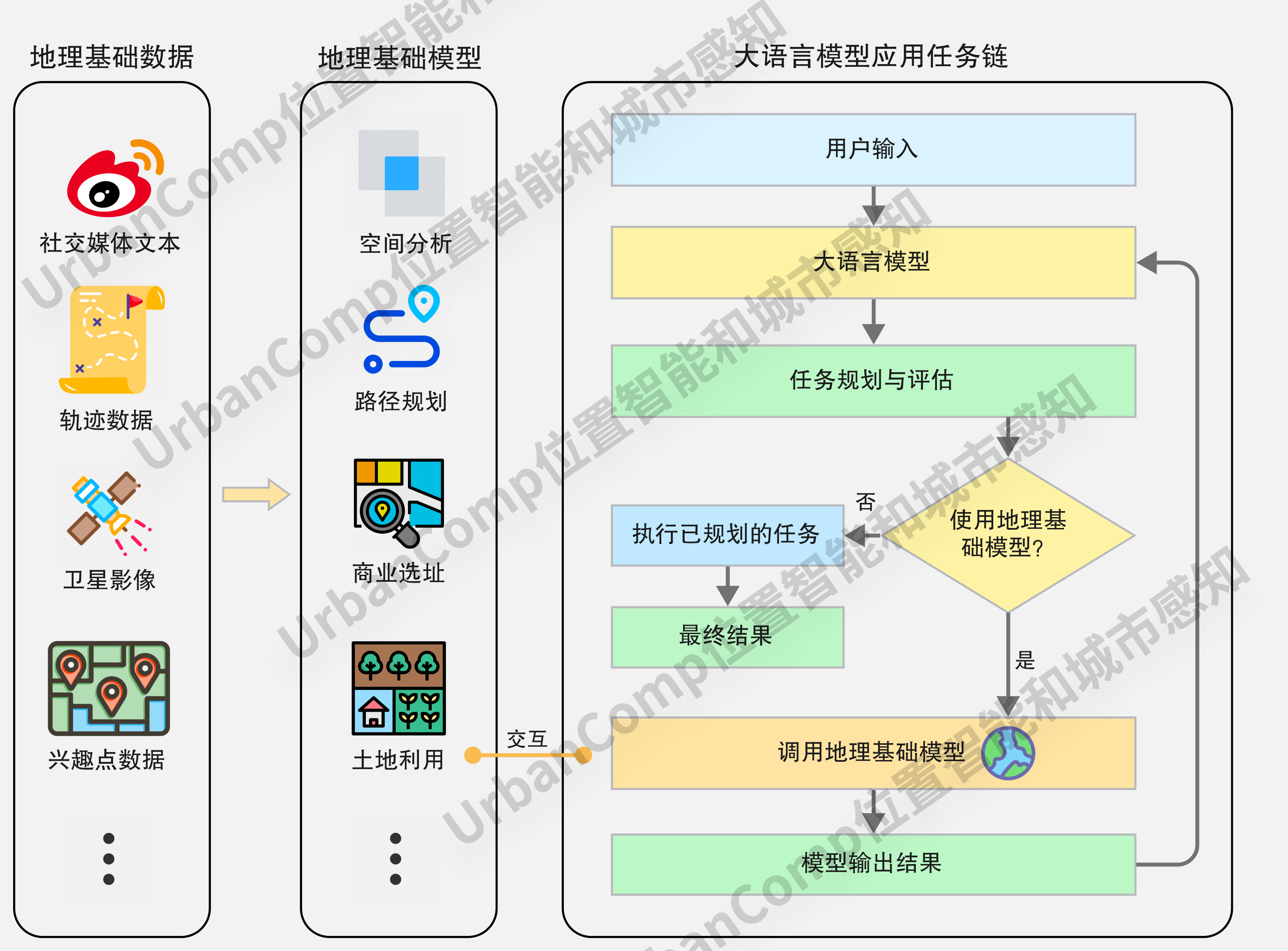
Its goal is to enhance user experience through the powerful natural language understanding capabilities of LLM. By using a series of scalable tools called GeoToolsChain (such as basic data crawling and buffer analysis), it empowers LLM to interact with complex geographic scenarios, enhancing its spatial awareness. It enables cleaning and filtering of geospatial information data, spatial analysis, and visualization capabilities. It can perform complex GIS operations based on fundamental geographic tools, solve common problems in the field of spatial information, lower the threshold for non-professionals to interact with it, and provide users with insightful suggestions and decisions.
Features
Integration of Multiple Data Sources
GeoGPT is able to autonomously decide and integrate multiple sources of geospatial information data. As an intelligent assistant in the field of geographic information, it can autonomously decide and integrate existing multi-source spatial data for subsequent spatial analysis and computation.
Spatial Analysis and Computation
GeoGPT has rich capabilities in analyzing and computing geospatial information data. We have built GeoToolsChain, which can call different analysis tools as needed to solve complex geographic tasks, complementing the ability of large language models in geospatial analysis and computation.
Text Report Generation
GeoGPT is capable of generating professional summary reports based on analysis results. With the powerful text generation and semantic understanding capabilities of large language models, it can understand user needs and generate geographical analysis reports that traditionally require a long time for expert teams to compile. This provides preliminary reference for writing the final product report, reducing the writing burden for practitioners.
Result Visualization
GeoGPT has excellent geospatial visualization capabilities. Traditional language models exist in the form of pure text chat, lacking intuitive result display abilities. Geospatial data relies on maps as carriers, so we provide rich visualization methods for language models to present spatial analysis results from multiple dimensions considering the special nature of geographic information.
Contribution
Enhancing the geographic spatial analysis capability of large language models
We have constructed GeoToolsChain, which integrates basic geographic spatial analysis tools and other geographic models, to improve the insufficient spatial cognitive ability of large language models. This enables them to have a deeper understanding and analysis of geographic spatial data on the basis of their original text semantic comprehension ability, providing users with more accurate and comprehensive information.
Lowering the operational threshold for GIS professional applications
Through interactive dialogue, we have reduced the complexity of traditional GIS software's graphical user interface, freeing users from being troubled by cumbersome operations. The large language model autonomously handles data selection, tool invocation, result display, and document summarization, simplifying users' complex professional software operations. By eliminating reliance on specialized background knowledge, even ordinary users can utilize GIS to solve daily problems.
Video Demo
[GeoGPT: Geographical Large Model, the Next Generation Intelligent Geographic Information System]:
Video Source Website(Bilibili)