Impact of Park Environments on Violent Crime in Wuhan: An XGBoost-SHAP Approach
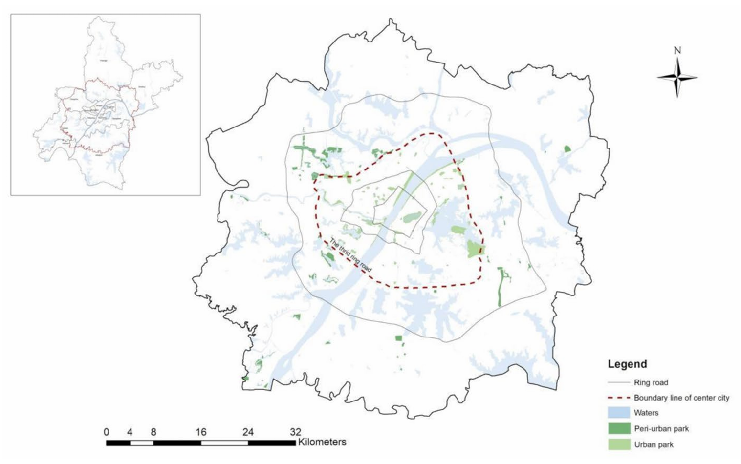
Title: Exploring the Impact of Park and Surrounding Environments on Violent Crime in Wuhan: An XGBoost-SHAP Approach


Title: Exploring the Impact of Park and Surrounding Environments on Violent Crime in Wuhan: An XGBoost-SHAP Approach
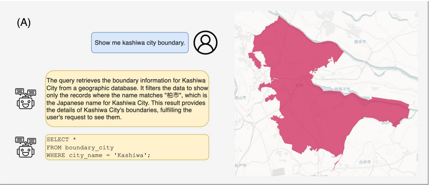
Title: Monkuu: a LLM-powered natural language interface for geospatial databases with dynamic schema mapping
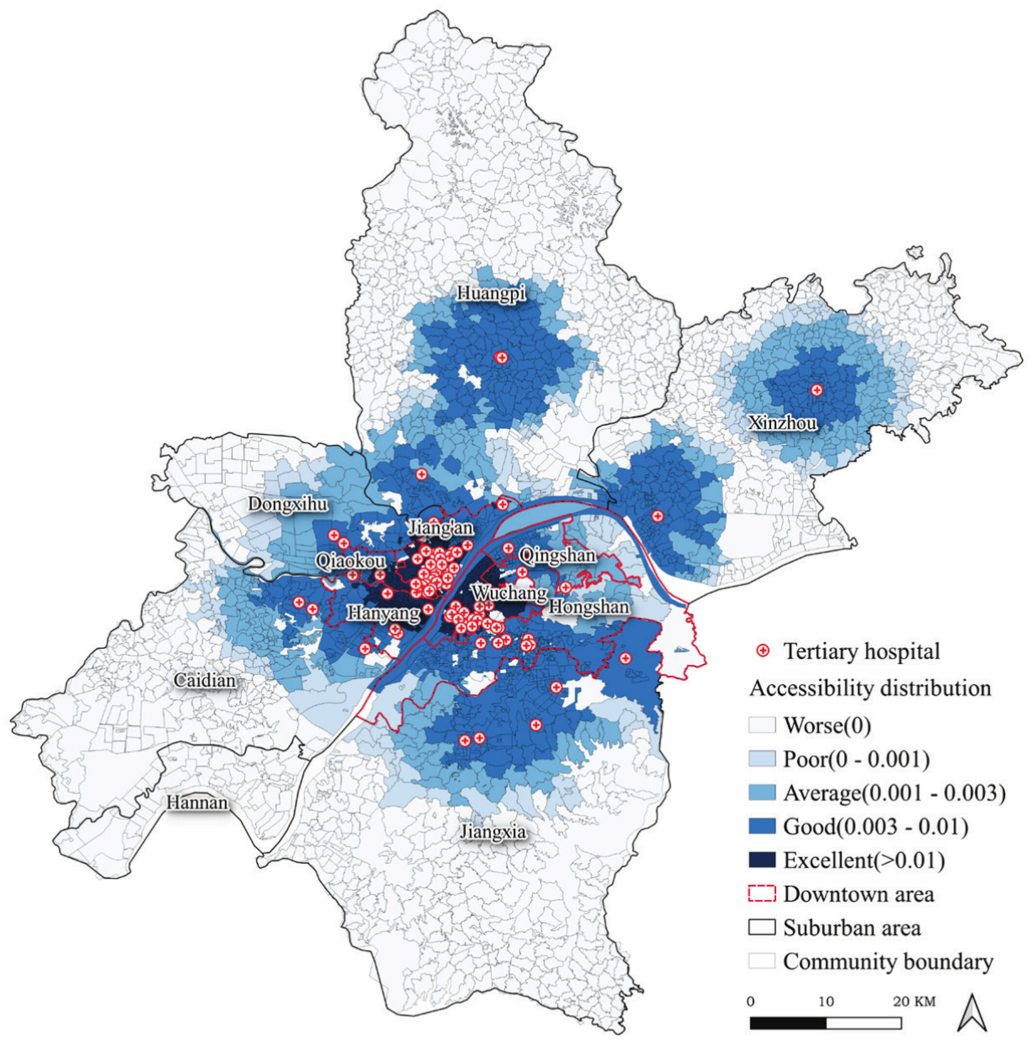
Title: Evaluation and Spatial Optimization Model of Urban Medical Resource Distribution Considering Equity and Efficiency
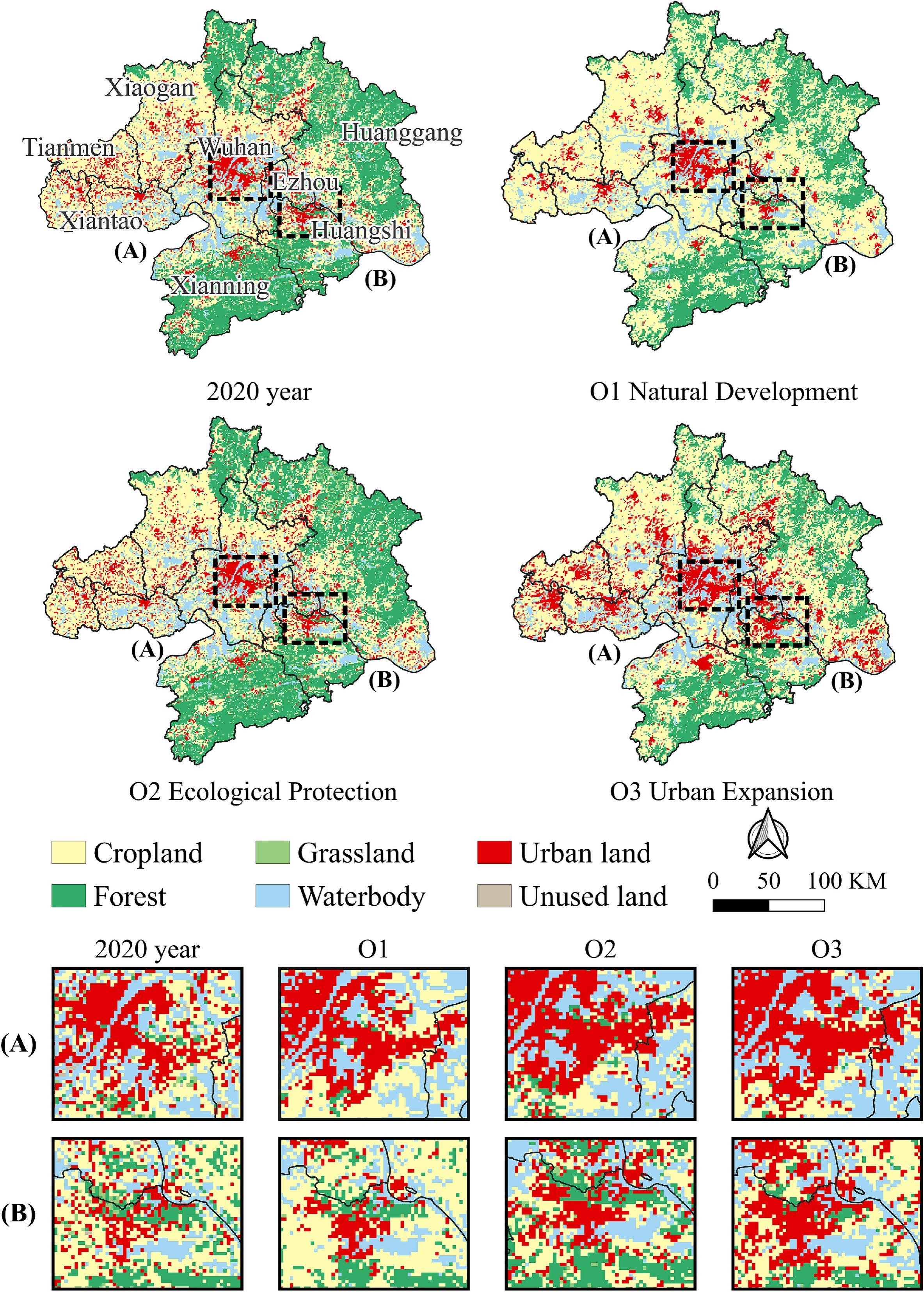
Title: CoCA: Spatial cooperative simulation and future prediction of “land-population-economy” in urban agglomerations
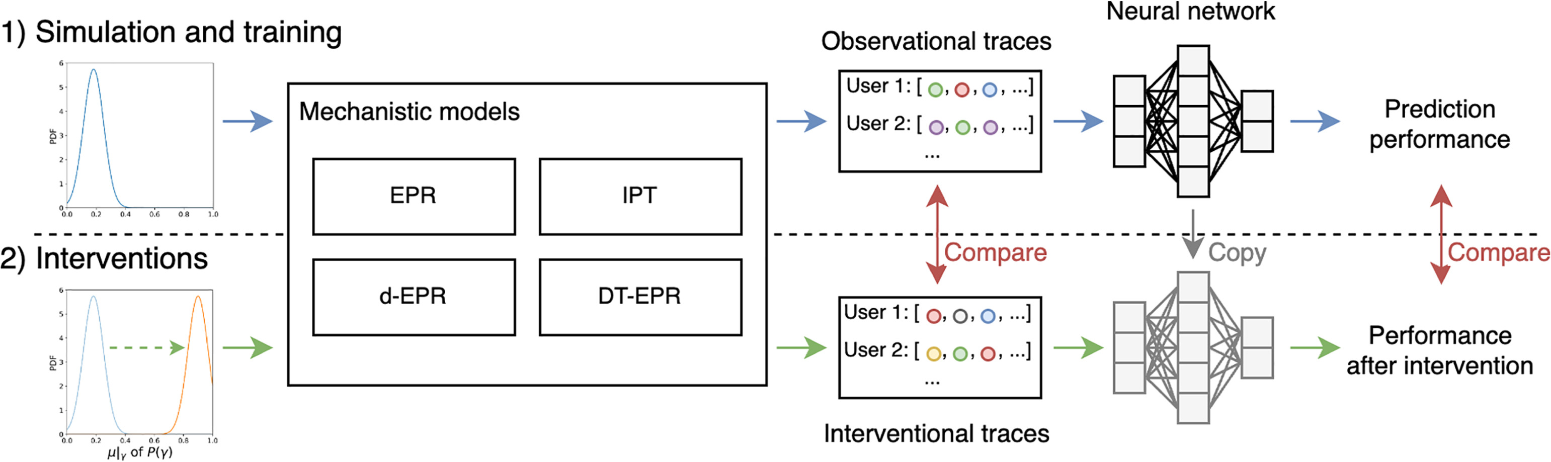
Title: A causal intervention framework for synthesizing mobility data and evaluating predictive neural networks

Title: Prediction and Analysis of Urban Mobility Based on Attention Mechanism and Geographic Information Embedding

Title: From Street View Imagery to the Countryside: Large-Scale Perception of Rural China Using Deep Learning

Title: Exploring the nonlinear effects of greenery on active travel among the ageing population

Title: LandGPT: a multimodal large language model for parcel-level land use classification with multi-source data
Title: A causal intervention framework for synthesizing mobility data and evaluating predictive neural networks
UrbanComp
![]()
![]()
![]()