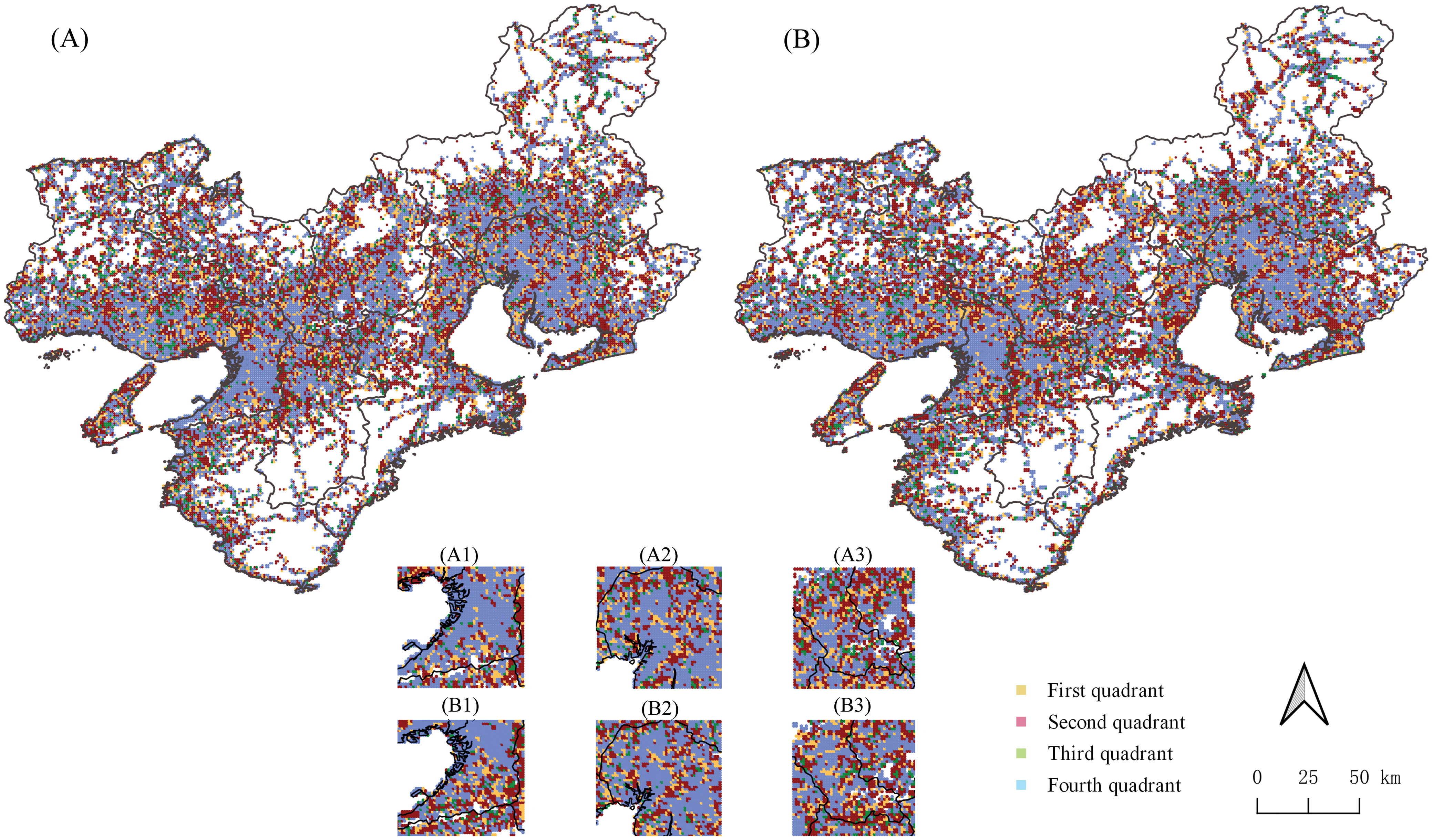
Resilience Patterns of Multiscale Human Mobility Under Extreme Rainfall Events
Title: Resilience Patterns of Multiscale Human Mobility Under Extreme Rainfall Events Using Massive Individual Trajectory Data


Title: Resilience Patterns of Multiscale Human Mobility Under Extreme Rainfall Events Using Massive Individual Trajectory Data
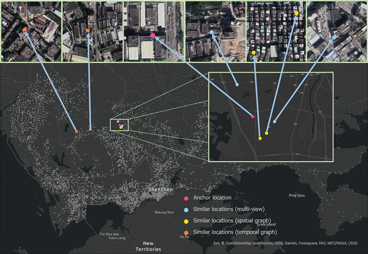
Title: Urban region representation learning with human trajectories: a multi-view approach incorporating transition, spatial, and temporal perspectives
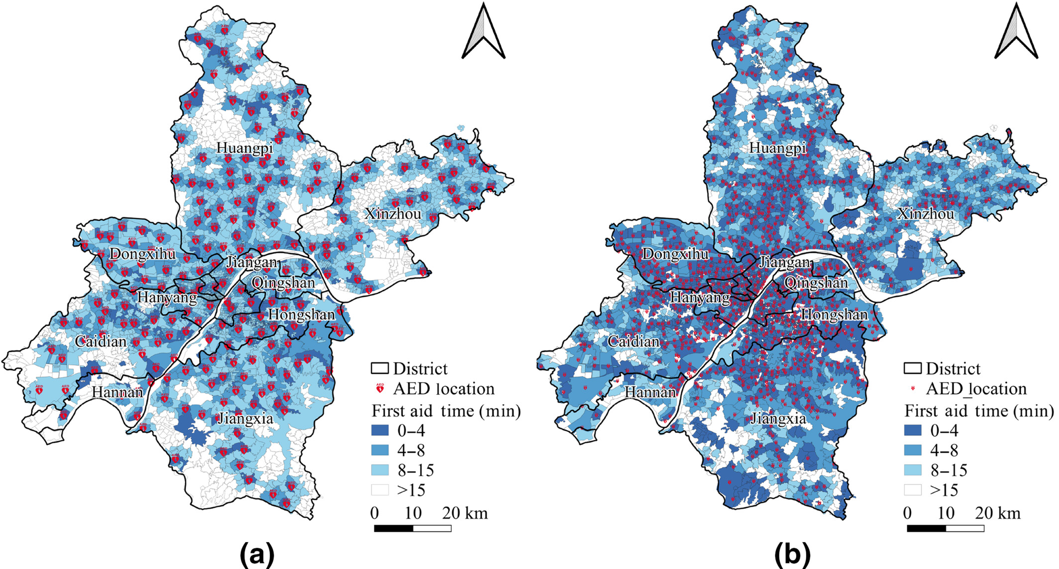
Title: Automated external defibrillator location selection considering myocardial infarction risk and medical resources
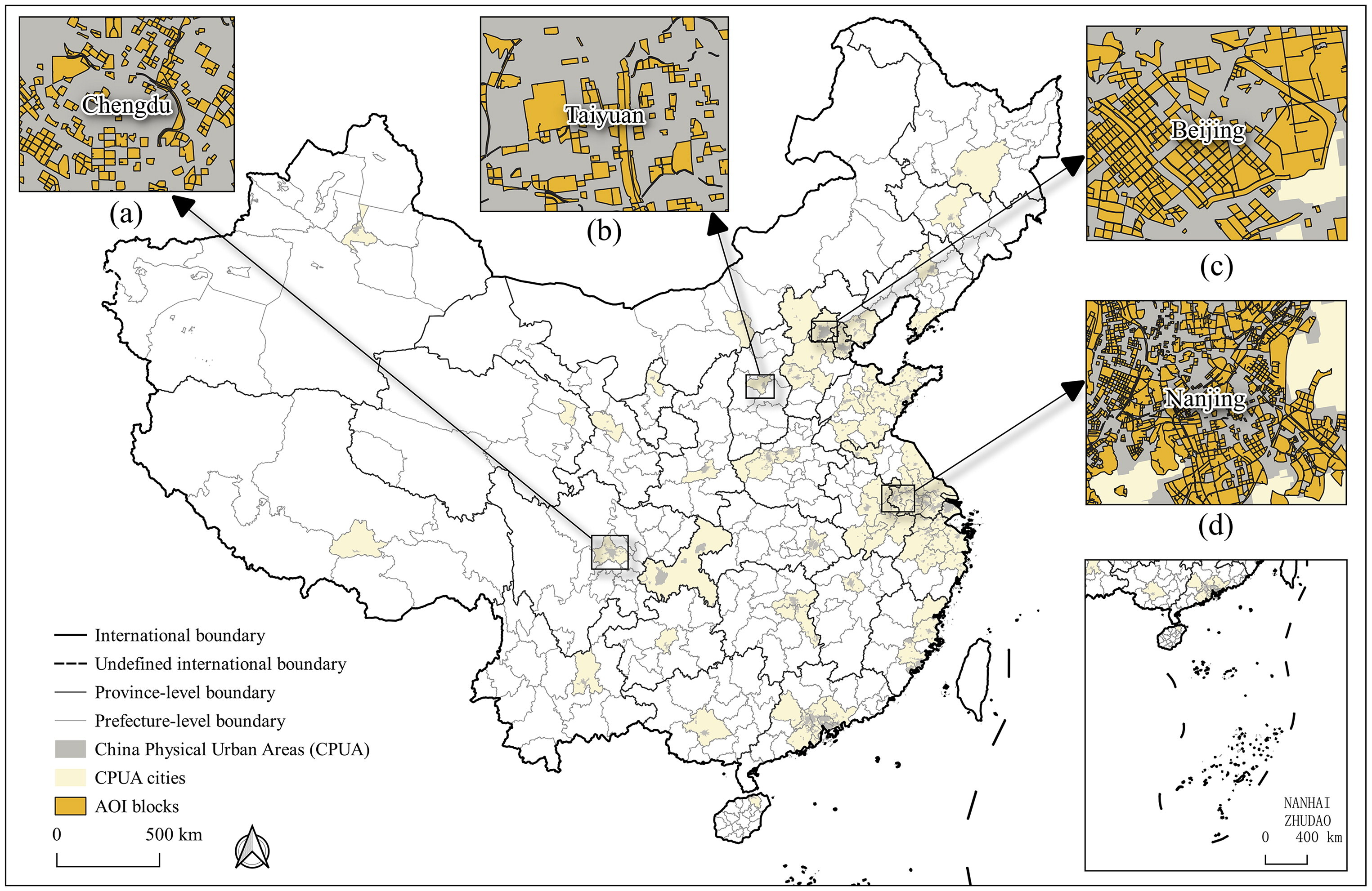
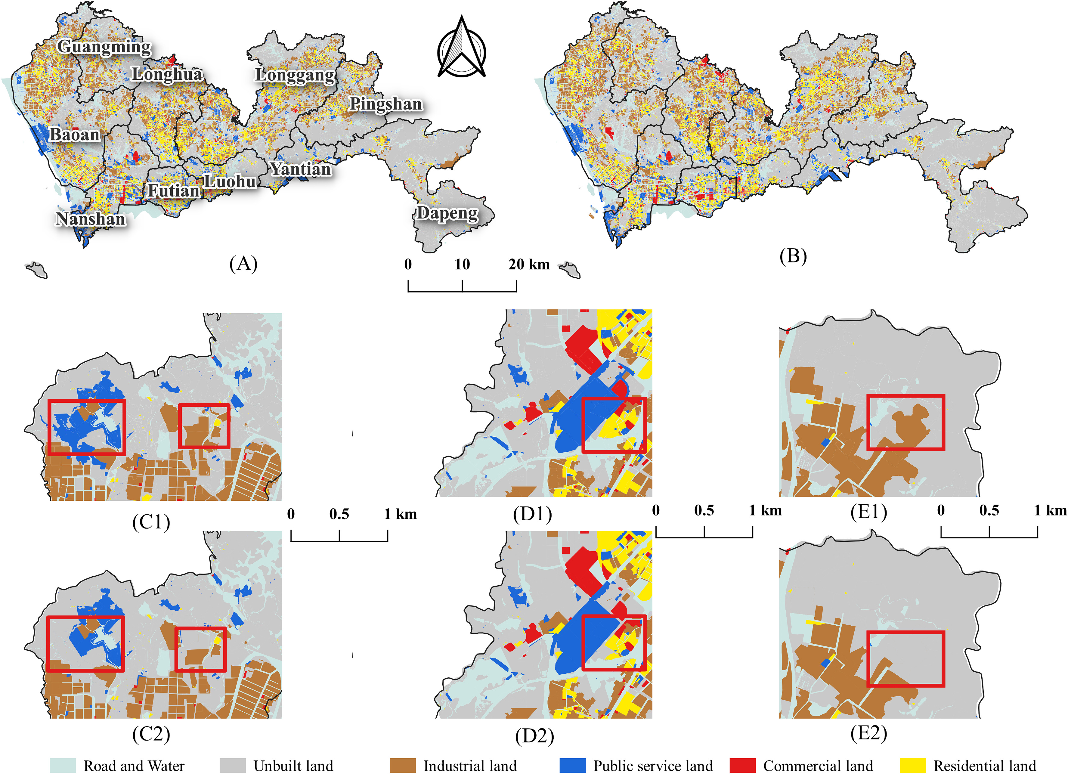
Title: DCAI-CLUD: a data-centric framework for the construction of land-use datasets
Title: HashGAT-VCA: A vector cellular automata model with hash function and graph attention network for urban land-use change simulation
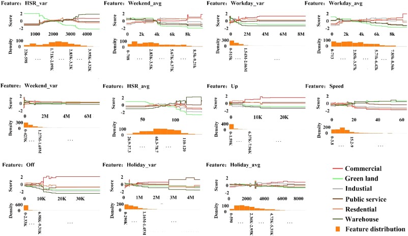
Title: A multimodal data fusion model for accurate and interpretable urban land use mapping with uncertainty analysis
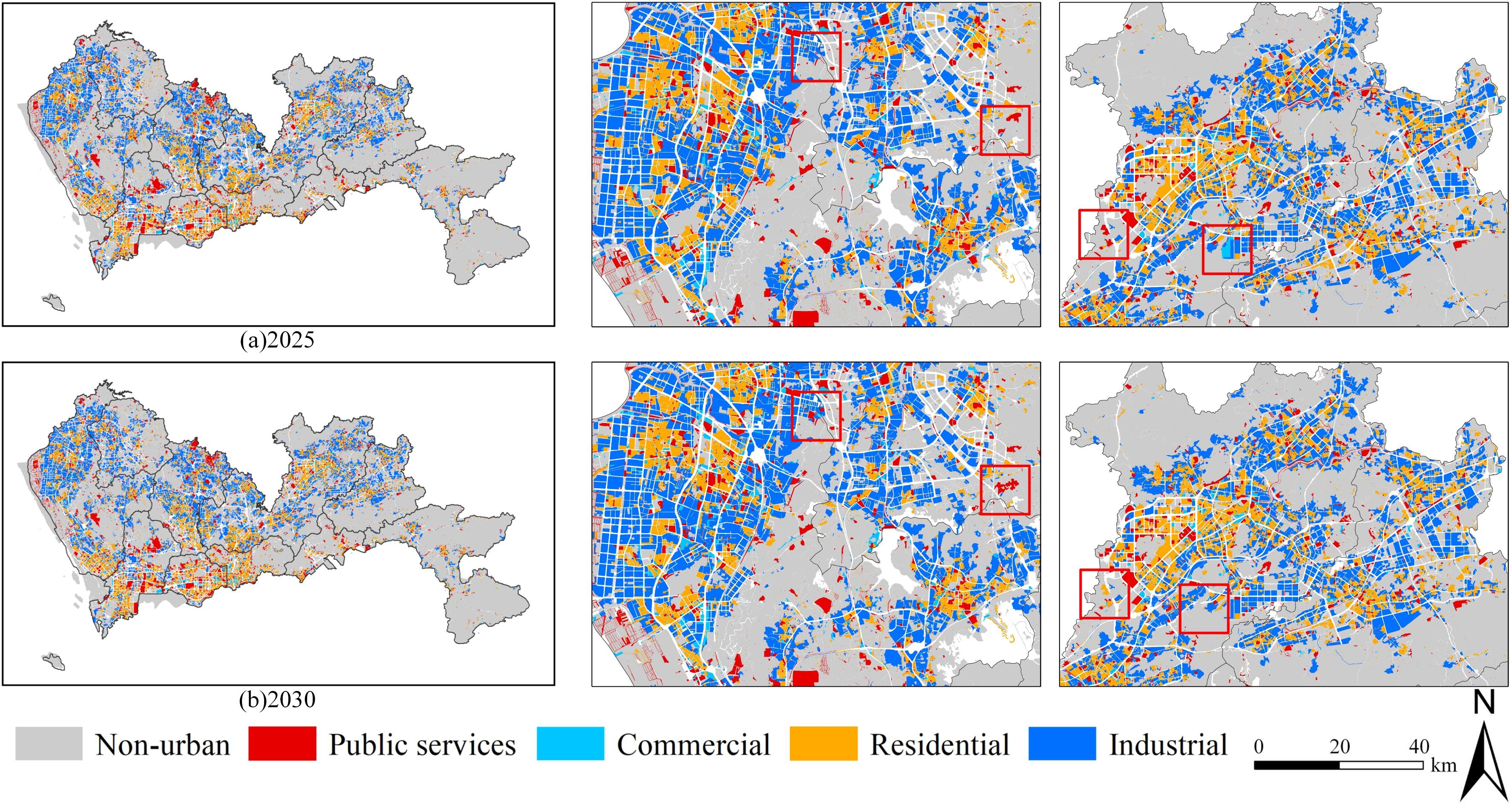
Title: Temporal-VCA: Simulating urban land use change using coupled temporal data and vector cellular automata
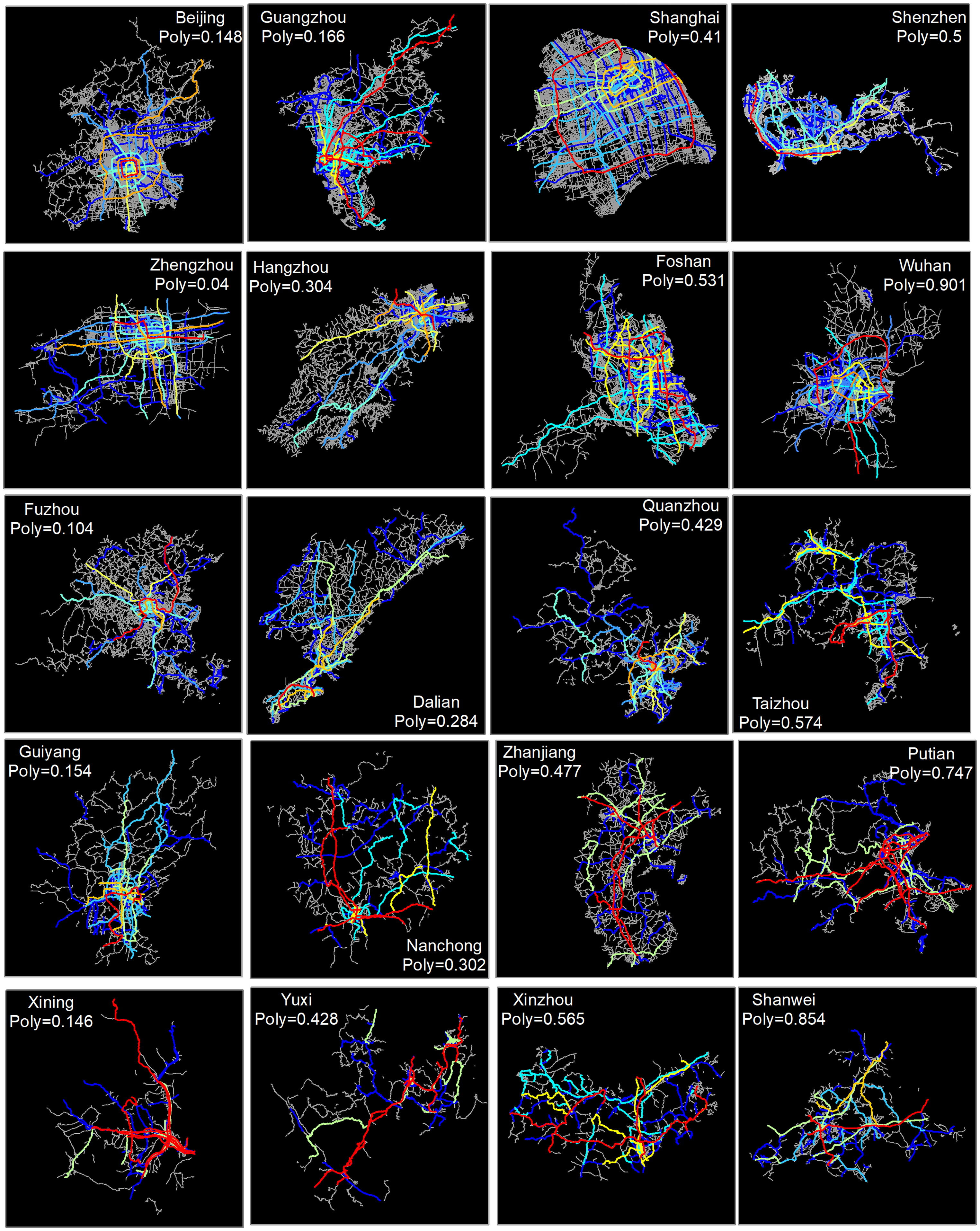
Graph convolutional networks for street network analysis with a case study of urban polycentricity in Chinese cities
Title:Predicting short-term PM2.5 concentrations at fine temporal resolutions using a multi-branch temporal graph convolutional neural networkAbstract
Title:Predicting the locations of missing persons in China by using NGO data and deep learning techniquesAbstractMissing person crimes can seriously a
UrbanComp
![]()
![]()
![]()