


VecLI v1.0.0:基于真实地块的矢量景观指数计算与分析系统软件
VecLI version 1.0.0: Vector land-parcel-based landscape index calculation and analysis system
在过去的两个月里,我们正式完成了UrbanVCA的测试及优化。考虑到传统的景观指数(Landscape index)都是基于栅格数据计算的,这会导致无法使用矢量城市数据计算城市景观格局,而且矢量数据转化为栅格数据还存在精度损失的问题。在矢量数据空间计算景观指数,会遇到地块过度破碎、数据结构极其复杂的问题。过大的技术难度导致研究者和城市规划人员目前没有有效的工具基于真实地块尺度分析城市景观格局。
In the past two months, we have formally completed the testing and optimization of UrbanVCA.
To our knowledge, the traditional landscape index is calculated based on raster data, which results in the inability to calculate urban landscape patterns using vector data, and there is also a non-negligible loss of accuracy in converting vector data to raster data. Calculating landscape index in vector data space will encounter the problems of excessive fragmentation of land-parcels and extremely complex data structure.
The high technical difficulty leads to the fact that urban researchers and planners currently have no effective tools to analyze urban landscape patterns based at the actual land parcel scale.
在UrbanVCA正式发布的同时,我们UrbanComp团队实现了VecLI version 1.0.0,一个基于矢量数据格式计算和评价地块景观指数的系统。VecLI可以基于真实地块计算的景观指数,和分析不同城市之间的景观相似度。
In conjunction with the official release of UrbanVCA, our UrbanComp team has implemented VecLI version 1.0.0, a system for calculating and evaluating landscape indices of land parcels in vector-based data format.
VecLI can calculate landscape indices based on real plots and analyze the landscape similarity between different cities.
VecLI提供了基础的矢量数据预处理模块,同时增加矢量数据属性字段的编辑功能。通过VecLI系统我们成功的开展了基于UrbanVCA的模拟结果分析和相似性度量。我们将会在UrbanVCA中集成精简版的VecLI模块。
VecLI provides the basic vector data pre-processing module, while adding the editing function of vector data attribute fields.
With VecLI system, we have successfully carried out UrbanVCA-based simulation results analysis and similarity metrics.
We will integrate the streamlined version of VecLI module in UrbanVCA.
考虑到矢量数据的复杂性,我们增强了VecLI内数据和算法的兼容性,可以适应属性信息缺失或有误的地块数据。
VecLI系统同时提供了计算地块重心坐标、周长及面积的功能和接口,用于矢量数据的预处理,确保任何地块景观度值的计算精度。
VecLI在运算过程中支持动态显示和对比不同邻域半径下的景观度值,用户可通过该功能获取最优邻域、实现相邻相似功能的地块合并和获取最合理的景观指数。
Considering the complexity of vector data structures, we have designed and enhanced the compatibility of data and algorithms within VecLI to accommodate parcel data with missing or incorrect spatial or attribute information.
The VecLI system also provides functions and interfaces for calculating the center of gravity coordinates, perimeter and area of a parcel for pre-processing of vector data to ensure the accuracy of calculating the landscape indices under any situations.
VecLI supports dynamic display and comparison of landscape degree values under different neighborhood radii during the calculation process, through which users can obtain the optimal neighborhood, realize the merging of adjacent parcels with similar functions and obtain the most reasonable landscape indices.
软件下载 (Binary Download):
由于v1.0版本已停止更新,请移步到VecLI v3.0 Beta (CHN/EN Version)下载最新版本
Since the v1.0 version has stopped updating, please move to VecLI v3.0 Beta (CHN/EN Version) to download the latest version
软硬件系统需求 (Software and hardware system requirements):
内存 >= 4GB (RAM >= 4GB)
硬盘空间 >= 3GB (Hard Disk Space >= 3GB)
Windows 8.1及以上版本 (Windows 8.1/10 or above)
Visual C++ Redistributable 2017
软件展示(Demo Display):
温馨提示:如果发生视频镜像错误,请直接进入bilibili查看:点此进入Tips: If the video playback fails, please click here
VecLI v1.0.0 功能介绍 (VecLI v1.0.0 Features):
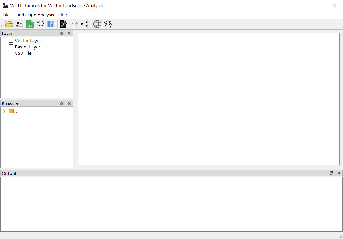
图1 VecLI 启动界面
Figure 1 User Interface (UI) for VecLI
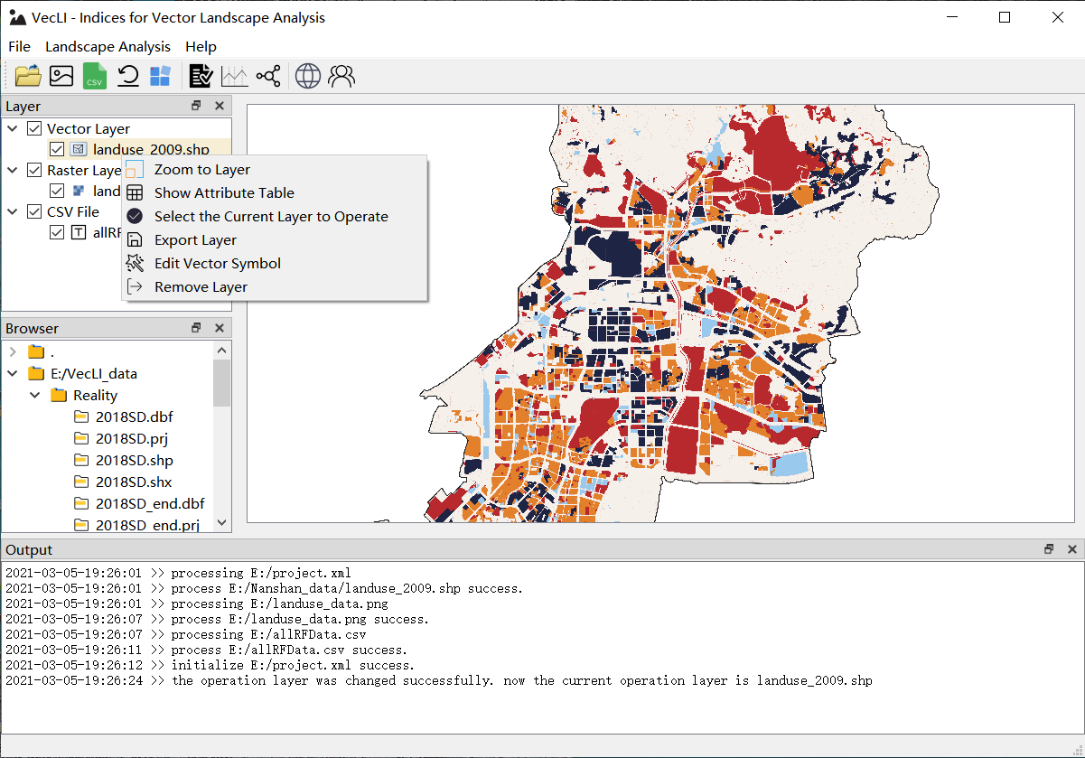
图2 矢量图层管理界面
Figure 2 UI for vector layer management
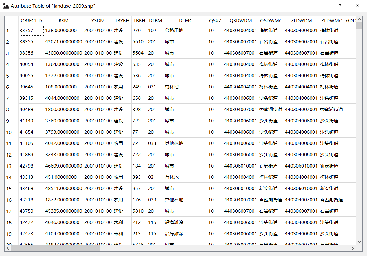
图3 属性字段编辑界面
Figure 3 UI for attribute field editing
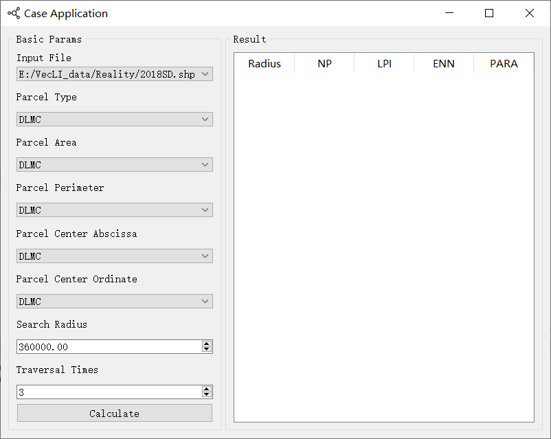
图4 景观指数计算及参数设置
Figure 4 Calculation of landscape index and parameter setting
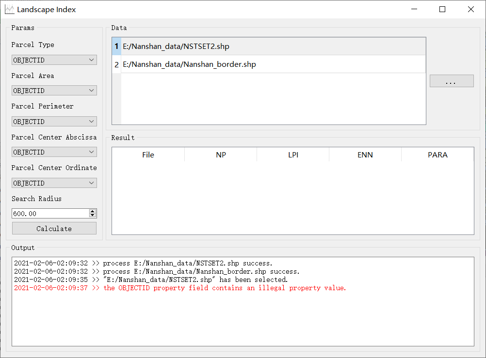
图5 计算与真实地块之间景观格局相似度
Figure 5 Calculating the similarity of landscape pattern between UrbanVCA simulation results and actual data
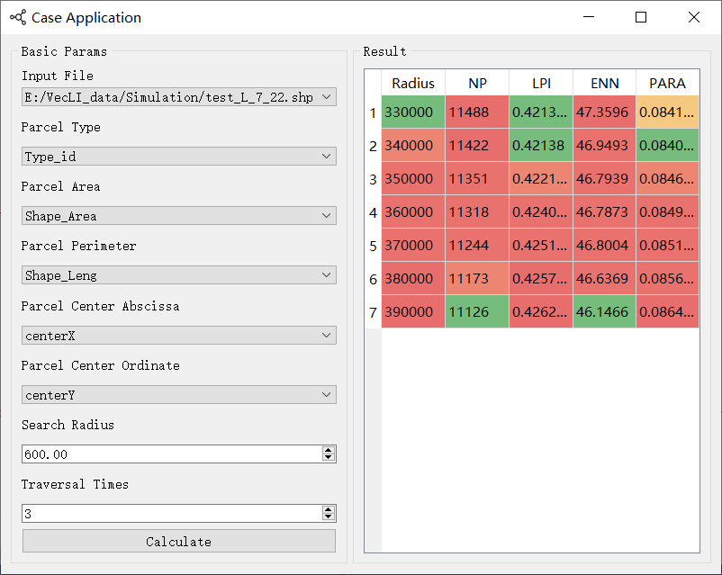
图6 自动挖掘不同邻域下的最佳景观度值
Figure 6 Automatic mining of the best landscape indices under different neighborhoods
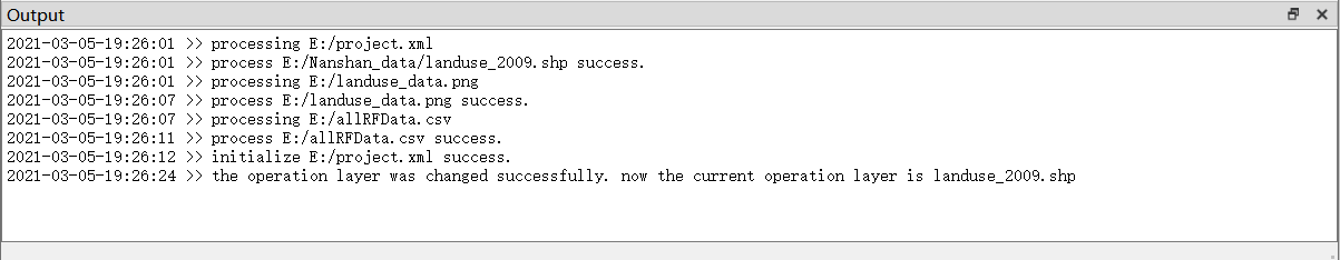
图7 VecLI实时监测和日志实时输出
Figure 7 Real-time output of monitoring and log files for the whole process of VecLI system operation
系统开发人员 (Developers):
Tao CHENG, China University of Geosciences, Wuhan.
Zhenhui SUN, China University of Geosciences, Wuhan.
Linlong LI, China University of Geosciences, Wuhan.
Yao YAO, China University of Geosciences, Wuhan.
Lefei LI, Didi Corporation, Beijing.
Qingfeng GUAN, China University of Geosciences, Wuhan.
参考文献(References):
-
Yao, Y., Li, L., Liang, Z., Cheng, T., Sun, Z., Luo, P., … & Ye, X. (2021). UrbanVCA: a vector-based cellular automata framework to simulate the urban land-use change at the land-parcel level. arXiv preprint arXiv:2103.08538.( arXiv )
-
Yao Yao, Tao Cheng, Zhenhui Sun, Linlong Li, Dongsheng Chen, Ziheng Chen, Jianglin Wei, Qingfeng Guan. 2022. VecLI: A framework for calculating vector landscape indices considering landscape fragmentation. Environmental Modelling & Software. 105325:1364-8152.( Inside Website , EM&S )
软件著作权(Software Copyright):
软件著作权 | VecLI:基于真实地块的矢量景观指数计算与分析系统软件
Q.E.D.