


Title: Formal and informal settlements and corresponding demographic patterns in Gaza Strip: deep learning approach to urban sustainability
Abstract
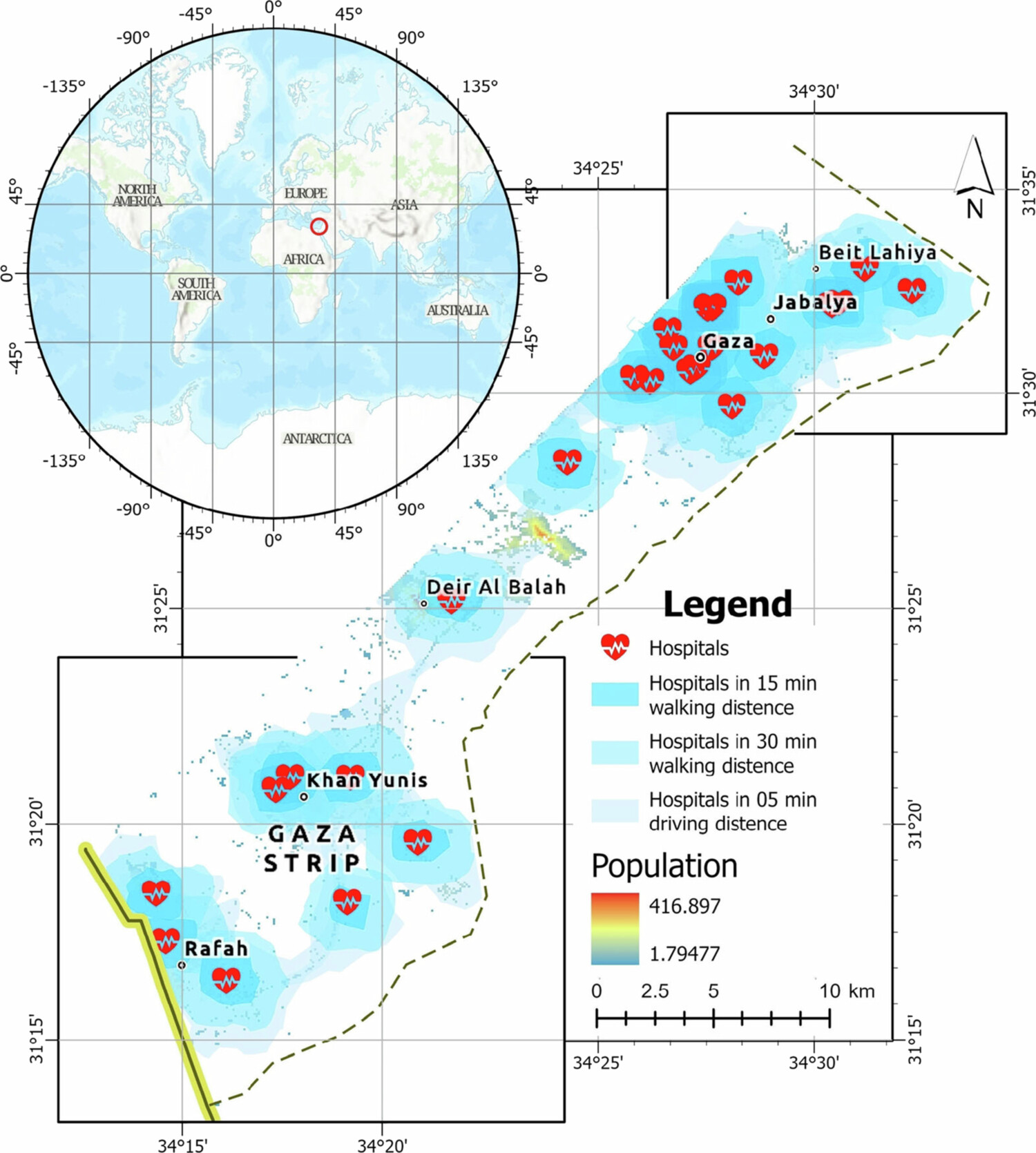
Understanding how formal and informal settlements grow and change, and their demographic features, is key for sustainable urban development (SDG−11). This study introduces a deep learning approach integrating satellite images, population, and healthcare data to track and forecast these settlements. Using a U-Net with ResNet−18, we accurately map formal and informal settlements. The Land Change Modeler (LCM) and Multilayer Perceptron-Markov Chain (MLP-MC) predict future settlement expansions, and linear regression projects population growth. Zonal statistics and OpenRouteService (ORS) reveal demographic patterns and accessibility to healthcare facilities. Our method achieves high accuracy (89.80%) in Gaza-Strip, effectively capturing settlement dynamics from 2000−2040. Results highlight significant demographic differences and critical gaps in healthcare access between settlement types, providing practical insights for urban planners and policymakers. The approach is scalable and data-efficient, making it ideal for conflict zones and rapidly urbanizing regions. This study contributes essential knowledge for monitoring SDG−11 and enhancing human-centric urban planning.
Keywords
Deep Learning;
Land Change Modeler;
formal and informal settlements;
demographic trends;
Gaza-Strip
Full Text Download
Q.E.D.