


Title: Explainable mapping of the irregular land use parcel with a data fusion deep learning model
Abstract
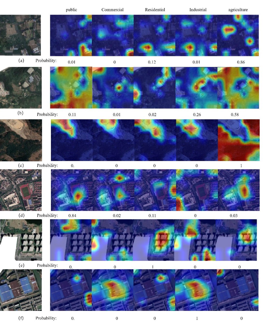
Real land parcels exhibit high variability in size and complexity. Existing deep learning-based models often rely on grids or simple resampling to ensure consistent input sizes, which is hard to accurately represent real land distribution while preserving information. Current research also lacks interpretability of model recognition and data fusion. To address these limitations, this paper introduces the Irregular Parcel Classification Model (IPCM), a novel multi-source fusion approach. IPCM uses Poisson disk sampling to regularize samples while retaining essential information. IPCM’s interpretability is analyzed by exploring its classification process and data fusion using Grad-CAM++ and Explainable Boosting. The results highlight the model’s attention to different functional categories in multimodal data and reveal the phenomenon of poorer fusion results for certain categories due to information mismatch during the fusion process. Furthermore, the model optimizes data fusion weight to enhancing the correct information to mitigating the negative impact when multi-source data information has excessive mismatch. Optimized IPCM achieves 0.892 test accuracy and 0.862 Kappa on irregular parcels. This research can serve as an important reference for high-precision land use mapping and understanding the data fusion process.
Keywords
Land use mapping;
Interpretability;
Deep learning;
Data fusion;
Point of interest;
Remote sensing;
Full Text Download
IEEE Transactions on Geoscience and Remote Sensing
Q.E.D.