


Title: CarbonVCA: A cadastral parcel-scale carbon emission forecasting framework for peak carbon emissions
Abstract
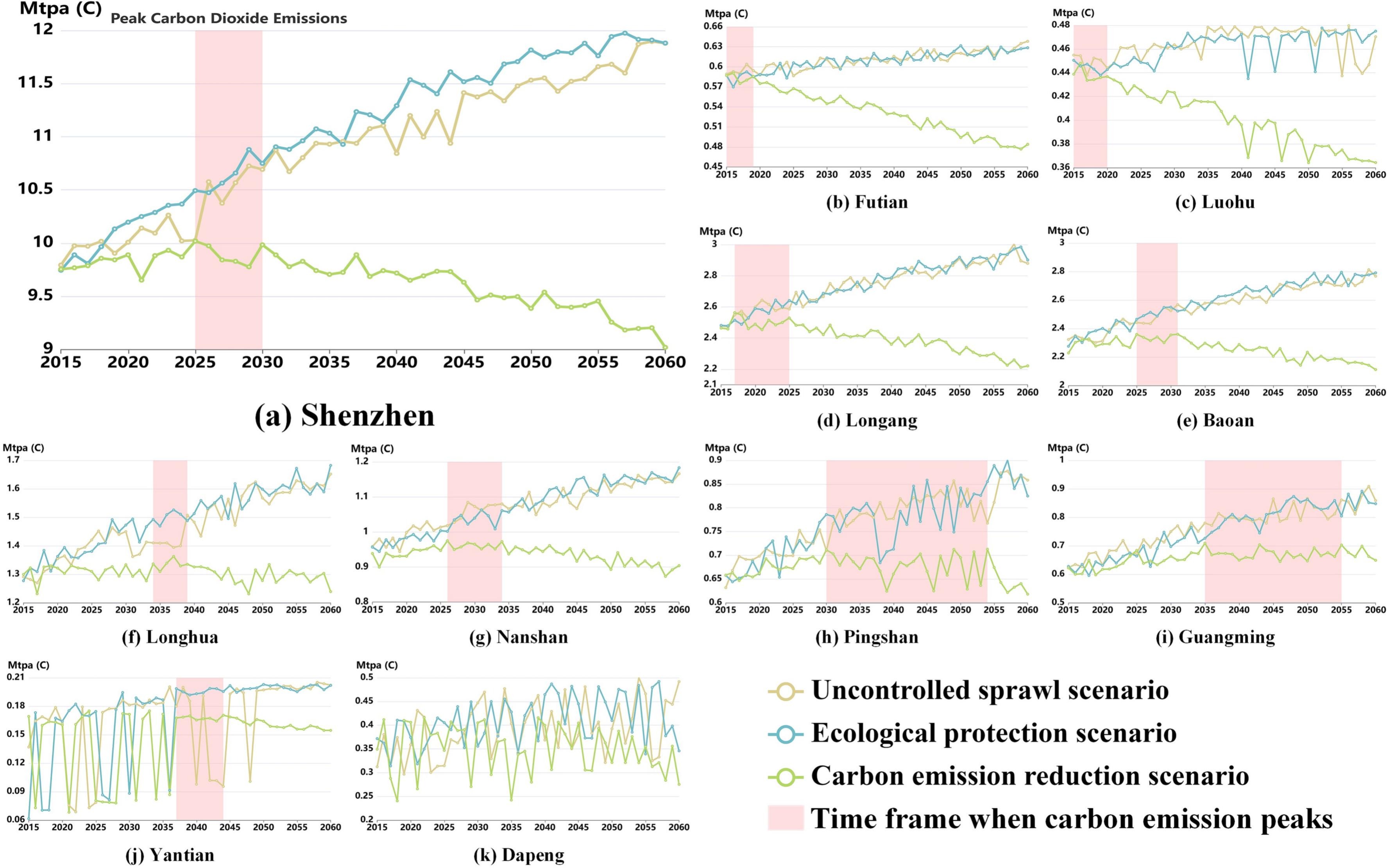
Forecasting cities' carbon emissions is an essential support for peak carbon emissions. Previous studies have mainly focused on estimating carbon emissions at large regional scales. Higher spatial resolution mapping of carbon emissions and simulation of future scenarios are important to support locally appropriate policy guidance to reduce carbon emissions. This paper proposes a bottom-up cadastral parcel-scale Carbon emission forecasting framework based on Vector-based Cellular Automata (CarbonVCA) by integrating land use modelling and carbon emission estimation. Shenzhen's cadastral parcel-scale carbon emissions from 2020 to 2060 are predicted as a case study. A good performance was achieved using CarbonVCA (MAPE = 19.017 %, RMSE = 0.175 Mtpa (C)). Three progressive scenarios are designed for carbon emission simulation from land use planning and energy structure restructuring perspectives. The designed carbon emission reduction scenario limits carbon emissions and enables Shenzhen to achieve peak carbon emissions between 2025 and 2030. However, the efforts to reach peak carbon emissions may prompt the relocation of industrial land to the suburbs. Such areas will need appropriate infrastructure construction to break through terrain and landscape constraints, maintain economic growth and achieve sustainable development. This framework can forecast a high spatial resolution of land-use-based carbon emissions, which helps construct low-carbon cities.
Keywords
Carbon emission forecasting;
Vector-based cellular automata;
Peak carbon emissions;
Cadastral parcel;
Urban ecology
Full Text Download
Software Download
CarbonVCA v1.0.0:A cadastral parcel-scale carbon emission simulation and prediction system
Q.E.D.