The distribution of greenspace quantity and quality with socioeconomic conditions in Guangzhou
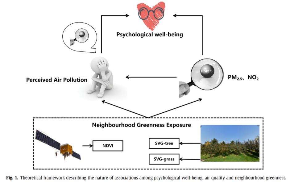
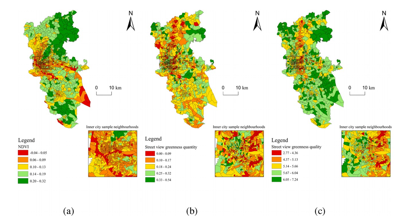
Awareness is mounting that urban greenspace is beneficial for residents’ health. While a plethora of studies have focused on greenspace quantity, scant attention has been paid to greenspace quality. Existing methods for assessing greenspace quality is either highly labor-intensive and/or prohibitively time-consuming. This study develops a new machine learning method to assess greenspace quality based on street view images collected from Guangzhou, China. It also examines whether greenspace exposure disparities are linked to the neighbourhood socioeconomic status (SES). The validation process indicated that our scoring system achieved high accuracy for predicting street view-based greenspace quality outside the training data. Results also show that there were marked differences in spatial distribution between aggregated NDVI (Normalized Difference Vegetation Index), street view greenness quantity and quality. Regression models show that neighbourhood SES is not associated with NDVI. Although neighbourhood SES is associated with both street view greenness quantity and quality index value, street view greenness quality is more sensitive to the change of neighbourhood SES. Our work suggests that policymakers and planners are advised to pay more attention to greenspace quality and greenspace exposure disparities in urban area.